Monday, January 19, 2026

Morning on Cockle Bay


We bedded down for the night in the large Heiltsuk cabin on Cockle Bay.  In the morning, we planned for a short 9 mile paddle to Gale Passage where we would spend the night.  From there, Greg would leave and paddle 16 miles solo to catch the ferry at Bella Bella while Dave and I carried on to Port Hardy. 

Since our planned mileage to Gale Passage was modest I had anticipated sleeping late so I was surprised to be wakened by Greg before sunrise.  He had been up a while drinking coffee and relaxing on the front porch but was now bent over my bunk with a finger to his lips signaling me to be quiet.  He whispered that he heard something walking on the rock shelf in front of the cabin.  He thought it might be a wolf. 

I slipped out of my sleeping bag and we tiptoed across the rough, uneven floorboards to the deck where we sat in the dark and calibrated our ears to the pre-dawn silence.  Listening carefully, we could just make out the faint footfall of an animal walking on the shelf out of sight to the left of the cabin. 

Soon, a wolf came into view, head down, intent on scavenging the tide line.  We held our breath and didn't move yet the wolf sensed our presence, looked up at us and froze a moment before his posture changed to prepare for flight.   He glanced back from where he had come and then walked quickly past us looking back as he went.  We heard the soft sound of more paws on the rock to the left and another pair of smaller wolves stepped in front of the cabin.  They quickly spotted us and took off back the way they had come. 

The larger wolf sat on the beach 50 meters to our right and began to howl.  The smaller pair answered him.  I had heard wolves before but these didn’t sound like anything I had ever experienced before.  Back and forth they called in an eerie, otherworldly language.  We could hear the smaller pair calling as they moved through the forest behind the cabin.  Soon, they joined their alpha and went about their business. 


I've never had a single bad morning on Cockle Bay.


Wednesday, July 30, 2025

Morning at Baker Point


We crossed CaamaƱo Sound to Aristazabal Island beneath thick fog and rising winds that would hit 25 knots before day's end. Landing in the lee of Baker Point before things got too sporty, we scouted for a campsite and found a small forest clearing—coated in eagle poop and barely big enough for one, maybe two tents. None of us fancied sleeping in that mess, so we opted for the logs instead. The weather radio warned of sustained northwesterly winds at 25 to 35 knots for the next couple of days.  It howled through the night.

Around 3:30 AM I got up to pee and assess the weather.  Crawling out of my tent I stepped towards the beach and on to something soft and alive.  Looking down, my headlight illuminated more toads than I had ever seen before.  The ground was covered with them feasting on insects that had come out of the beach detritus.  Stepping carefully, I walked forward towards the water until I was in a no toad zone.


I stood there and did my business while looking the four miles across Laredo Channel to where the mountains of Princess Royal Island were backlit with the dark rose promise of sunrise.  The sound of the wind in the trees and the chattering of the whitecapped seas provided the soundtrack as I looked straight up at black sky that was jampacked with stars. Suddenly a large yellow/orange meteor came into my vision from behind the trees on a NE heading.  It was colorful and shedding fiery debris, seemingly slow-moving and just before reaching the horizon, it faded and disappeared. 

After that I couldn't sleep so I fired up my Jet Boil to make coffee.  At the sound of my stove Greg crawled from his tent as he can never pass up the possibility of a cup coffee. 

Perched on a log, coffee in hand, we spoke of wind and water and toads and meteors while watching the sunrise paint the morning sky.

Wednesday, June 18, 2025

West Coast of Calvert Island with a Few Sites Near Cape Caution - A Field Guide for Paddlers


West Coast of Calvert Island

 with a Few Sites Near Cape Caution

A Field Guide for Paddlers


Why?

This is chapter three of an effort started in 2011 to fill in some gaps in the Wild Coast series of guides by John Kimantas.  The 2011 effort resulted in a guide for the west coast of Banks Island, and in 2012 we produced a guide for west coasts of Aristazabal, Price and Athlone Islands.  Like the two earlier guides, sites covered by The Wild Coast: Volume 2 are not included except by reference.

Who?

In 2013 we had ten paddlers, mainly from the Nanaimo Paddlers.  We started in Bella Bella near the end of July and finished in Port Hardy mid August.  We had remarkably good weather and calm seas for all but the last day or two and the water was noted to seem warmer than usual.  Nice for swimming and for making fog.  All members of our group contributed to the survey effort with most of the photos taken by Geoff Mumford, Karina Younk and Glenn Lewis.  Most of the post trip organization of information was done by Reale Emond and Glenn Lewis.

Overview of the Surveyed Area

From the northwest corner of Calvert Island to the south end of Burnett Bay is a little more than

50 nm, going more or less directly.  The entire distance, except for some of the south shore of Calvert Island, is entirely exposed to the open Pacific.  The area is well known for its large sand beaches that seldom get visited other than by the ever present wolves.  Many of the beaches have little shelter from swell, and our goal was to find places which allowed for landing without surf when conditions were suitable for paddlers of ordinary ability.  Except for the Hakai Beach Institute located in Pruth Bay at the north end of Calvert Island the entire survey area is uninhabited.  When crossing from Calvert Island to the mainland, paddlers might see a few sports fishers from Rivers Inlet, but this year even they were not in evidence.  There is a considerable amount of marine traffic using Fitzhugh Sound and the coast south of Calvert.  Paddlers will want to be aware of this situation and possibly keep in contact with Vessel Traffic Services during exposed crossings.  Coming home mounted on the bow bulb of a cruise ship would take some of the fun out of paddling in the area.

The area is generally flat near the coast but Fitzhugh Sound, Rivers Inlet, and Smith Sound can cause strong inflow/outflow winds and currents which can contribute to the challenges of rounding Cape Caution.  The southwest shore of Calvert Island is also prone to very choppy conditions, and the NW wind seems to access most of that area unimpeded.  Whether this situation is because of the low elevation of most of the western half of Calvert Island, because of inflows into Rivers Inlet in the afternoon or the relatively shallow water closer to shore, we don’t know.  One solution is to paddle half a kilometre off shore of the islands, another is to paddle inside of the islands, rocks and reefs.

The area was easy to paddle during our trip, but the lack of cover from the open ocean means that sometimes paddlers would need a much larger stock of discretion rather than valour.  There is a small cabin near the north end of Burnett Bay which appears to be well used by kayakers and a couple of camps abandoned by the late Bill Davidson.  Obvious evidence of past First Nations use is harder to discern than in the areas where beaches were more amenable to being shaped for harvesting purposes.

Monday, June 16, 2025

West Coast of Aristazabal, Price & Athlone Islands – A Field Guide for Paddlers Includes Rennison and Anderson Islands


West Coast of Aristazabal, Price & Athlone Islands 
Includes Rennison and Anderson Islands
A Field Guide for Paddlers


Why?
This guide is chapter 2 of an effort started in 2011 which sought to fill in some gaps in the Wild Coast series of guides by John Kimantas.

The 2011 effort resulted in West Coast of Banks Island – A Field Guide for Paddlers.  Like the Banks Island guide, areas covered in The Wild Coast Volume II are not included in this chapter, except by reference.

Who?
In 2012 nine members of the Nanaimo Paddlers club decided to survey the western shores of Aristazabal (including all of Rennison Island and Anderson Islands), Price and Athlone Islands.  It was a good test for the campsites as eight tents needed to be accommodated.  All members of the group contributed to the gathering of information.  Most of the photographs were taken by Geoff Mumford and Karina Younk.  Most of the pre-trip survey preparation and post-trip organization of the information was done by Reale Emond and Glenn Lewis.  


Overview of the surveyed area
From Oswald Point on the northwest corner of Rennison Island to Cape Mark southwest of Athlone Island is about 80nm going more or less directly.  However, those wanting a shorter open water crossing of Laredo Sound at the south end of Aristazabal and an alternative to the 8-9 nm crossing of Milbanke Sound at the south end of Price will need to paddle an additional 15-20 nm.  The area is isolated but not so remote or unoccupied as Banks Island.  Sports fishers from the North King Lodge located in Borrowman Bay on Aristazabal Island will be seen from the north end of Aristazabal down at least as far as Clifford Bay.  Similarly, the West Coast Resorts lodge near Athlone Island spread their guests between Cape Swain and Cape Mark.  In an area that is several hours away from the life boat stationed in Bella Bella, the presence of sports fishers provides some additional support should an emergency arise.

The survey area is uniformly quite flat and is largely part of a formation known as the Milbanke Strandflat.  This means that shallow waters extend west of the main shore line.  Between Cape Mark and Oswald Point there are between 500-1000 islands or islets and perhaps twice that number of rocks and reefs, mostly within a mile of the main islands.  Most of the time, paddlers will be either fully or partially protected from sea states farther to the west.  Another benefit of the low topography is that most of the clouds that will drop rain on the hills and mountains to the east carry on by without stopping.  Ocean swell that was often substantially blocked by Haida Gwaii further to the north becomes more noticeable as one moves south from Clifford Bay on Aristazabal.
We found the area relatively easy to paddle for a western exposure, mainly due to the large stretches of inshore paddling available that were fully protected and the relatively short exposures to the open ocean.  Paddling the area does require open water crossings of Laredo Channel (about 4.5 nm), Laredo Sound (about 6.5 nm from the south end of Aristazabal over to Price going directly), Milbanke Sound (about 5 nm from Langford Cove on Price Island to Salal Island or 8-9 nm going directly from the south end of Price Island to Athlone Island).  Aside from the presence of sports fishers, the area shows few signs of human use except for two cabins near the northern end of Aristazabal and a whale observation post at Ulric Point.  Weather information comes from the Klemtu repeater in the northern sections and the Calvert Island repeater further south; reception is generally quite good.

Sunday, June 15, 2025

West Coast Banks Island - A Field Guide for Paddlers


Why?

Since the publication of the Wild Coast Series by John Kimantas and Boat Camping Haida Gwaii by Neil Fraser, kayakers have been able to paddle almost all of the west coast of British Columbia more safely and enjoyably. A gap in the Wild Coast series, quite understandable given the size of the project, is a lack of information for most of the west coast of the outer islands from Larsen Harbour on Banks Island to Cape Calvert on Calvert Island. The information provided here aims to fill part of that gap. Areas already covered by the Wild Coast series are not included.

Who?

Four members of the Nanaimo Paddlers (its what it sounds like) decided to survey the western shores of Banks and Aristazabal Islands in the summer of 2011 and make the collected information available to those who can use it. The collective experience of those involved in the survey and preparation of this field guide includes paddling all but about 60 miles of the western shores of British Columbia South of Prince Rupert and Cape Knox to Tofino. An injury resulted in the trip being diverted homeward after the completion of the west coast of Banks Island leaving Aristazabal for another day.


Overview of the surveyed area

From Deadman Point on the northern tip of Banks to the area around the southern tip is between 45-50 nautical miles going more or less directly. Subjectively, aside from headlands like Cape Scott, Cape Cook and Estevan Point, we found the area comparable to the west coast of Vancouver Island north of Tofino in terms of challenges for the touring paddler.

The area is very isolated and paddlers should plan to look after themselves, expecting help from outside to come, but perhaps not in a very timely way. In 2011, there were no people living along the west coast of Banks and we encountered only one sail boat and no sports or commercial fish boats near to shore. The shore shows very few signs of post contact historical development. In short, it is an isolated wilderness experience. Leave your ego and schedule at home, bring an extra VHF, and enjoy.

Thursday, December 12, 2024

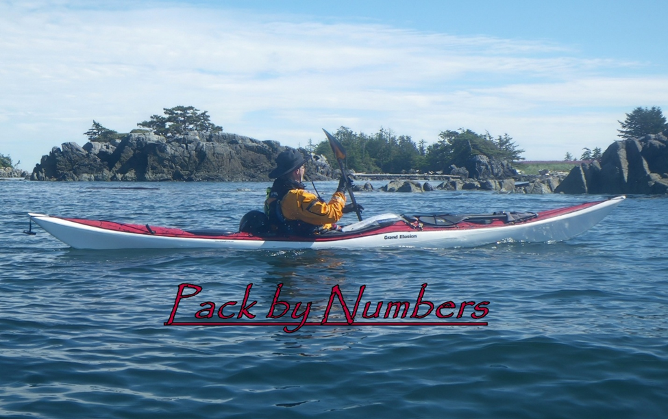
Pack by Numbers

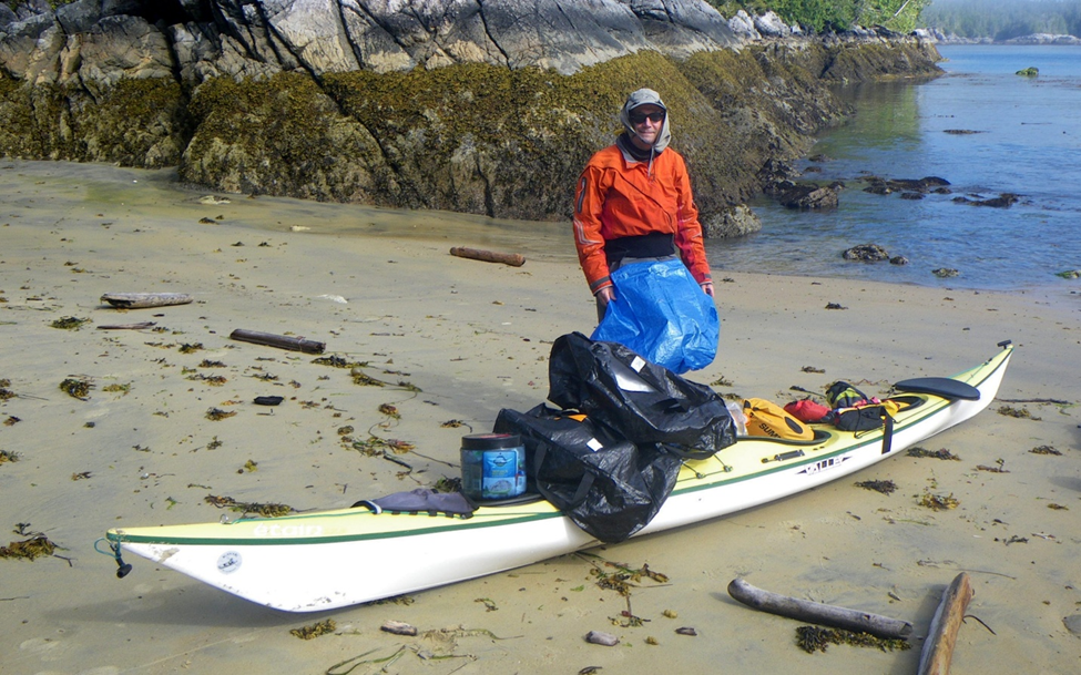
Loaded and trimmed for 3 1/2 weeks

As with all things kayaking, folks have found different solutions that work for them and have differing opinions.  Sometimes the solutions are well conceived and other times not-so-much.  I’m going to discuss my method of packing for a kayaking trip for a single overnight or for a month at a time.  Since I’ve never been out for more than a month my experience hits a wall at that point.  This is what works for me.

My first rule is no deck loading.  The only kit on the deck will be a spare paddle, chart case, GPS and helmet.  Nothing but navigation and safety gear.  There is an issue with windage that comes with deck loading but for me it is about safety and deck access.  When things go sideways that deck may be your only friend and savior.  If it is cluttered with bags, carts and furniture safety can be severely compromised.  My helmet is the only item on the back deck and it is attached in a manner that allows it to be easily removed and discarded if in the way.   


Basics: 

  • Take only what you are really going to need.  
  • Know what every item weighs and distribute the weight so that the boat retains its empty balance.  In other words, it is not stern or bow heavy unless you know from personal experience that it performs better in ALL conditions when loaded in an unbalanced state.
  • Place heavy items closer to the cockpit with lighter items towards the bow and stern. 
  • In your kit selection prioritize packed size over weight. 
  • There should be no unsecured gear in the cockpit. 
  • If you can’t fit it in the hull set it aside for now as you probably don’t need it. 


Take only what you need:

  •  Bring basic clothing.  No extra stuff.  This ain’t no party, this ain’t no disco, this ain’t no fooling around.  Don’t worry about having the perfect layer. 
  • Choose clothing and gear that serves multiple purposes when possible.   If you have a Storm Cag you don’t need a separate raincoat and how many different shoes do you really need?.   
  • Don’t try to pack clean clothes for each day.  That takes up too much space. 
  • Accept that you are going to get dirty and you are going to stink.  Wool stinks less than synthetics.

Gear weight: 

  • Some folks try to color code their drybags or label them with hangtags that describe the contents.  Good ideas and those are nice-to-haves but not gotta-haves.  The gotta-have is how much does each bag or loose item weigh.
  • I use mostly small and/or compression drybags with two tapered bags with purge valves for bow and stern.
  • Once you have all of your necessary gear assembled and bagged, weigh each item and record that on a spreadsheet. 


Start packing it into the boat where it makes sense to you while being mindful of “heavy-to-the-center-light-to-the ends.  Did it all fit INSIDE the hull?  Check your spreadsheet to see how close to balanced are you? Start figuring out what items need to go fore or aft based on weight, size and shape to achieve balanced trim while fitting INTO the hull.  It may take you a while to get the weight properly placed to achieve trim. 

  • Didn’t all fit?  OK, start figuring out what your nice-to-haves are and set them aside.   Keep working at it until you have fit all of your gotta-haves INSIDE the boat in a balanced fashion. If you find room for a nice-to-have that’s a score! 
  • Figure out how much water you REALLY need to carry and put it into bags.  I prefer the MSR Dromedary Bags but others work well and they conform to available spaces.   Plastic water bottles are inefficient as they don’t conform and take up as much space empty as they do when full. 
  • Don’t carry more water than you need.  I seldom carry more than I will personally need for two or three days though I take a 10-liter, 6-liter and 4-liter bag for clean, filtered water.  With my filter I pack two dirty-water collection bags which combined packs smaller than a 2 liter Nalgene bottle.
  • Know that a 10-liter bag holding only 4-liters will fit into spaces that a 4-liter bag will not. Empty Dromedary Bags take up very little space, essentially the size of their non-conformable cap.  Water weighs about 2 pounds per liter and bags can be moved around to balance your boat.  It’s a puzzle.  It’s all about space!

It all fits INSIDE the hull

Practice!!!!!: 

  • Now that you are balanced and have fit your gotta-haves INSIDE the hull start practicing packing and unpacking. 
  • Have two beach bags.  Large Ikea bags are great as they are cheap, light and take up nearly zero space when empty.  Use one for the cockpit forward and one for behind the cockpit.
  • Practice until each item is always in the same place and you can pack fast with or without daylight.  When you have performed enough reps to be efficient you will know exactly what is inside every bag by location and feel and won’t need color-coding or labels.  Once you have practiced enough that you know what each item is and where it lives, practice some more. 
  • Have some spare time before dinner?  Great! Go out into the garage and practice some more.

Stages of packing

You never want to be the last person packed and off the beach because you are fidgeting with your gear and trying to figure out where everything goes.  There are many people that you don’t want to be in this life and the last person off the beach is one of them.  


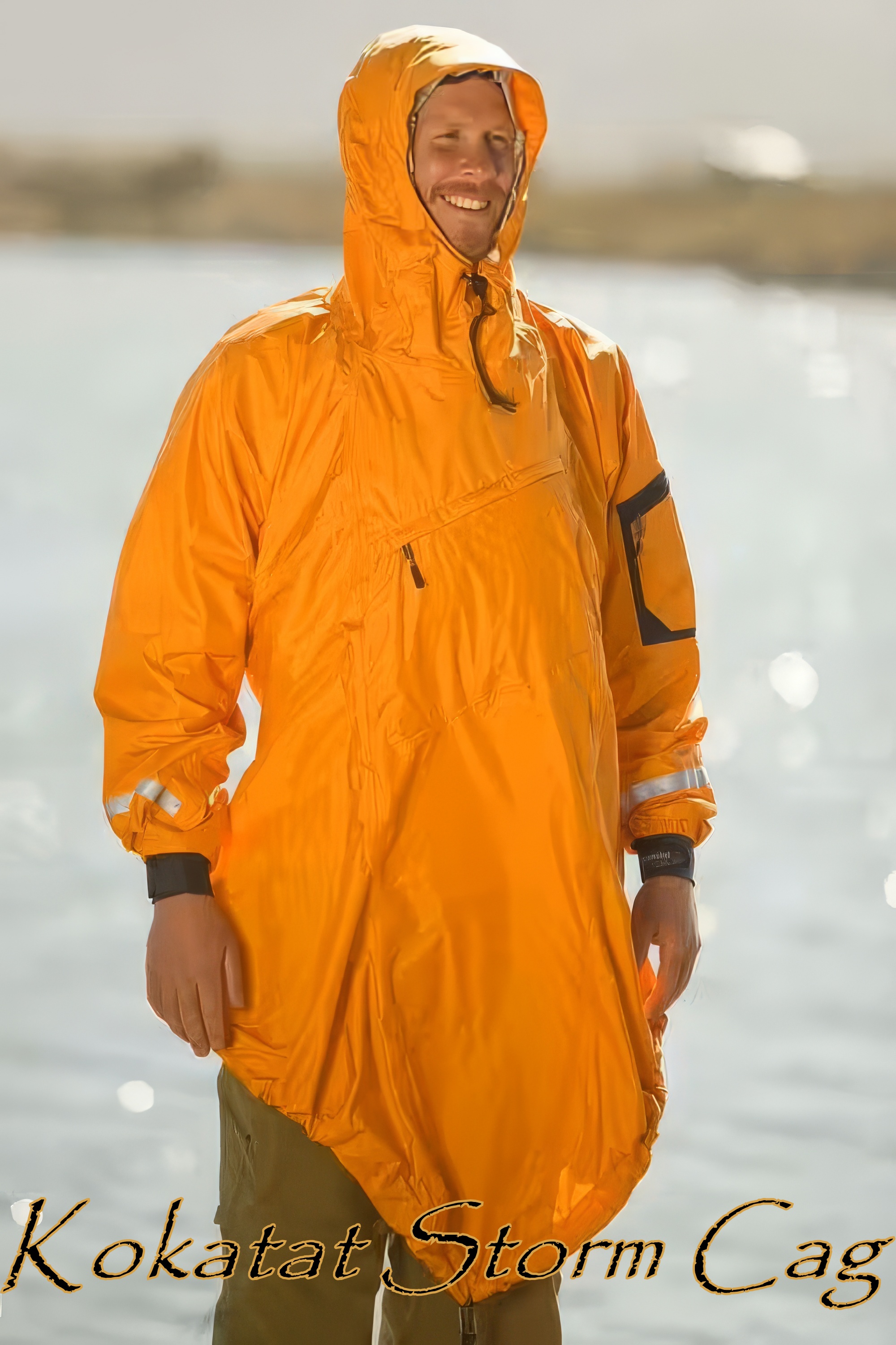
Kayak Packing Hacks - Kokatat Storm Cag


Image courtesy of Nautopp Kajakcenter Grebbstad


Paddling the Northwest Coast can be a cold and wet affair.  While all Pacific coastal residents own multiple rain jackets made of various materials that feature numerous doo-dahs that seal, vent, hood, snug and are acceptable restaurant and clubwear anywhere in North America very few of them were designed with our disease in mind.  Consequently, for paddling, all of their doo-dahs fall well short of addressing our paddling needs.  With all of the pockets, vents and adjustments they can only be worn under a PFD on the water or on the beach.  Their sole saving grace is that they help us look stylish on the shore.

Enter the Kokatat Storm Cag.  Guaranteed to look goofy on the shore and deemed acceptable clubwear only in British Columbia and Alaska it is featured on the bodies of intelligent paddlers all over North America.  It has very few doo-dahs but does have everything that we really need. 

The cut allows it to be pulled on over your immersion gear and PFD while seated in your boat and secures around the coaming of your kayak.     The adjustable hood can be used with or without a helmet.   It features a fleece-lined kangaroo handwarmer pocket with a small velcroed opening allowing you to access pockets in your PFD, There is also a zippered pocket over the kangaroo pocket that I personally find very useful.  If you unzip that pocket you can stuff the garment into it while turning it inside out, Zip that shut and you have a fleece-covered pillow for sleeping. 


The shape of the cag allows you to sit down and tuck your legs inside for warmth.  Sort of a truncated personal bothy bag.  I have bivi-ed in this garment and will attest to the added warmth it provides overall but also for your toes and feet.   


Loosely packed it is scarcely larger than a Jetboil stove and since it is flexible it will fit into a space that the Jetboil will not.  With the Storm Cag you are carrying a rain layer for paddling and for shore, a wind breaker, bothy bag and pillow.  Such a deal and a great space saver inside your kayak.   

If you don’t mind looking a tad goofy on shore, take one of these instead of your ramma-lamma dead-dinosaur GoreTex wonder jacket.  I’ve worn mine on BC Ferries, campsites and all over Prince Rupert but never once have been kicked out of a restaurant, lounge or bar.  It is the only rainwear that I pack for kayak trips. 


Wednesday, December 11, 2024

Kayak Packing Hacks - Toilet Paper

Note paperback book in the right corner of the window


How much to bring?  How little can I get away with?  My first coastal trip was with a nature boy who thought that leaves and smooth rocks were acceptable substitutes for #2 hygiene.   He didn’t bring any toilet paper at all and I quickly learned that his smooth-rock-requirement severely limited the number of beaches that we could camp on.  I felt that his Mr. Nature approach was extreme but I wanted to fit in so I pretended to go along with his plan but stole as much toilet paper as I could from the “Queen of Chilliwack’s” mensroom.  I hid this tree-wasting contraband in my boat and would only take it out when needed.  I nervously performed regular inventories and it wasn’t long before I realized that demand was outstripping supply.  What to do?   

On Day 8 I bid adieu to the very last of my secret, stolen toilet paper.  I was really depressed at the thought of what was coming next but then, miraculously, my luck changed.  I found a damp and mouse-eaten paperback book delicately balancing on the empty window frame of the dilapidated cabin on Triquet Island.  I quickly stuffed it down my pants before nature boy could see it and claim it as community fire starter,  No way was I going to share this bounty with him.  He was welcome to all of the barnacle covered rocks and cedar bows that he loved so much and of which there were many. 

At the conclusion of that trip I quit paddling with Nature Boy as I felt that I had learned everything he had to teach me and adopted my own toilet paper sensibilities which embraced "more-is-better" as a key tenet.  The problem, though, was that while TP is light it takes up a lot of space so I found a way to reduce that volume and fit it into spaces that often go to waste.  This is what works for me. 

Four Rolls in the Space of Two

Take a large leak proof bag and shove two rolls of toilet paper into it.  I use 10” wide zip locks.  Sit on the bag to smoosh the rolls and compress the paper and while still sitting on it close the airtight seal.  Now open the seal just enough to insert a straw and suck the remaining air out.  Seal the bag.  Take a length of jute or some other flammable line and tie it around the bag.  Leave a length of line on each sealed bag.  Two to three feet is probably plenty.  Tape the bag tight ensuring that the line is secured to the bag.  Don’t laugh but I pack 8 rolls this way into 4 bags.  Take a bit of colored electrical tape and put a different colored tape on the end of each line.  Red, white and blue is my go-to.  The bags will be oval and elongated.  I shove them one at a time into the very stern or bow of my boat as it is space seldom used for anything else.  Force them back there in an order so that you can remember which string to pull for the next bag of TP (hence red, white and blue).  The jute can be burned and the bags can be reused at home.  

In case you are curious about the book, by wild coincidence that paperback was “Roughing It” by Mark Twain.   I shit you not. 

Monday, November 18, 2024

Kayak Bill Camps - Dallas Island

Originally published October 17, 2017


Dallas Island was one of Bill’s primary camps.  At ~21NM from Shearwater it was midway to his camps on Aristazabal.  Dallas is located along the eastern edge of Milbanke Sound and at the entry to Finlayson Channel where it provided superb shelter and a clear view of conditions on Milbanke Sound prior to committing to crossing over to Higgins Passage.  It was a one or two day paddle from his shack on Brian Clerx’s property that he referred to as “Denny Island Camp”.  By leaving Shearwater near the turn to ebb he could get to the Ivory Island / Blair Inlet complex at the turn to flood.  This would give him a push north to Dallas for the final 7 NM.  If conditions or tides didn’t cooperate there were bivy camps scattered along Seaforth Channel and a couple of camps in Blair Inlet where he could hole up.


In 2007 Dave, Greg and I stayed at the Dallas Island Camp.  Bill had spent eight days here in June 2003 on his way out to his more remote camps and had spent two more nights in October on his way back to Denny Island Camp.  He was headed back to Shearwater to do some painting and resupply for what would turn out to be his last trip.  He had just two months to live. 

Monday, August 12, 2024

Bivi at Safety Cove


On day 14 of our 2023 trip from Klemtu to Port Hardy Dave Resler and I ended up at a place called Safety Cove on east side of Calvert Island.  That came at the end of a 22-mile day grinding against rain driven by 15 kt headwinds and a moderate sea state.  Hard work in snotty conditions.  We figured that with a name like Safety Cove we would find a decent place to camp.  We had earned it but no such luck.  What we found was a sliver of high slope shell “beach” that would barely survive the 12.4’ high tide while providing no room for tents.  The backing forest was impenetrable.  There were two big logs that we could sit between in an upright fetal position, so I strung my tarp over them.  It was tight but would have to do. 

This was to be a wet, windy drysuit bivi in our PFD’s, hooded Storm Cags, wool hats, and spray skirts around our necks for added insulation.  I pulled the foam seat from the Grand Illusion to insulate my butt and put on my last dry Glacier Gloves.  We piled all our drybags on top of our legs and spread Dave’s ultralight tarp over us for a blanket.  It felt OK for about 30 minutes. 

The cold wind and rain continued through the night and, having firsthand experience with hypothermia, I monitored my temperature closely.  Shortly before sunrise the wind dropped, the rain stopped, and I actually fell asleep for 30 minutes or so. 

Not the worst night I have spent on the BC coast but still earns a rating of Type III fun.


Thursday, February 29, 2024

Never Turn Your Back on the Sea


Honolulu’s own Duke Paoa Kahinu Mokoe Hulikohola Kahanamoku is recognized as the  Father of Surfing and during his life gained worldwide popularity as an Olympic swimmer, all round waterman and humble philosopher.  Many popular quotes track back to him during his 77 years and maybe the most famous is “Never turn your back on the ocean”. 

Duke Kahanamoku
1910 - Library of Congress - 10653

The late, great Eric Soares was a spectacular modern-day waterman in his own right.  Co-founder and Commander of the Tsunami Rangers he and his crew introduced the world to a gonzo sea kayaking discipline that is called Rock Gardening.  While Eric departed this plane in 2012, he left us with his Ten Commandments of Sea Kayaking.  Knowing a good idea when he heard it he borrowed from Duke and his First Commandment is “Never turn your back on the sea”. 

Eric Soares
copyright Michael Powers

Monday, September 11, 2023

Klemtu 2 Port Hardy 2023


After six years of retirement preparations, Covid restrictions and the business of selling our house, buying a new one and moving to Everett it was time to return to the BC coast and the Great Bear Rain Forest.  It had been even longer for my paddling partner, Dave Resler, who made it clear that he was going, no matter what.  All he asked me to do was all the planning and preparations.  Piece of cake, right? 

Honestly, I wasn’t convinced that he would really be able to go so I put off planning longer than I normally would have and when I did start I found that all of my nautical charts and charting tools had disappeared in our move.  Unbelievable!  I bought enough replacements to cover the waters between Port Hardy and Caamano Sound as I figured that I could come up with something interesting there but then found that Garmin had discontinued support for Homeport, the charting program I use.  Double unbelievable!  I had lost significant functionality in their decision to cast me aside but figured out enough workarounds to where I could get by. 

With my new charts and crippled Homeport application I decided to create a trip that would be familiar yet have enough new twists and turns to be interesting.  I felt that it would be most efficient (and fun) to ferry up to Klemtu and paddle back to Port Hardy by whatever route struck our fancy and that the conditions would accommodate.  Most of our “planned” campsites were just options and not hard and fast daily destinations.  Heresy, for some, but that's how I roll.  It would be a vague route that would allow us to change with the wind.  The chart work took me a couple of months of consistent work to complete. 

After losing all of my charts, finding my charting program “broken”, several of my dry bags delaminated, battery cases rusted shut, some safety gear expired or worn out and other key gear missing in action I shouldn’t have assumed that I was through the “broken phase” of the trip.  And I wasn’t. 

Dave had a new Garmin Mini 2 that would allow limited texting.  Since this brought a new expectation to our trips and because I was sensing that there might be some communication issues regarding conditions, movement, etc. I asked local paddler, mentor and all around good guy, Bill Porter, to act as our interpreter when and if a message really needed clarification and the guy who would handle things if we really needed help. 

This is the story of the Carhartt Duct Tape Tour.

Thursday, June 1, 2023

Joey-Walks-with-White-Feet


Originally published December 2019

A significant storm approached as we were exiting Gale Passage.  Gale bisects the Bardswell Group and opens into Thompson Bay which faces south into the open Pacific.  If you were to continue south from Thompson Bay your first landfall would be Antarctica.  That is a hard-to-comprehend amount of fetch and while this storm wasn’t being driven by some historic low-pressure system that movies are made of it was big enough to get every sea-going vessel’s attention and it was going to make Thompson Bay an unfriendly environment to the extreme.  There may have been good places to hide from a storm in the bay but they were hiding from us and were not marked on our charts with the exception of Cree Point and Islet 48 which lay another 3 NM upwind from Cree.  Dave and I had previously stayed at the Heiltsuk cabin on Quinoot Point located 2 NM in the wrong direction and downwind from Cree.  We viewed it as our last resort option.  We thought that, if need be, we could probably slip through the backdoor route between Dufferin and Potts Islands that is blocked at low tides and requires a slippery and ankle breaking portage. 


Saturday, October 1, 2022

Marcel Speaks


Originally published 4/21/2021

On my second day of skiing I participated in a series of bad decisions that nearly cost me and my friends our lives.  Being in high school at the time when bad ideas and bad decisions were a way of life the only thing that is surprising is that we survived.  Without belaboring details let me just say that we had gotten lost and were suffering from hypothermia.  We were rescued by three remarkable men, two of whom told me years later that when they found us, we had maybe 2 hours to live.  Two of those men were very kind but the third was a beast.  

The beast was a German expat named Marcel Schuster who had served on the Russian Front in WWII as a Nazi Mountain Trooper.  He was captured and spent three years in a POW camp which didn’t make him a nicer person.  He was entirely unpleasant and totally unsympathetic to our situation.  During our rescue the only six words he uttered to us were “You Stoopid Boyzzz” and “Learn or Die” followed by another “You Stoopid Boyzzz”.  After eight years I was reunited with the three men who I owed my life to and Marcel didn’t smile and wouldn’t shake my hand.  All he said while looking at me with a cold and bitter stare was “You Stoopid Boyzzz”.  

I’m going to get to the kayaking part in a minute but before I do I want to mention what a strong influence Marcel’s message has had on my life choices.  Though I have met no one who knew him who would describe him as a nice guy he spoke to me in a way that got my attention and that I understood.  

I think that many of us choose our activities, boating or otherwise, where we accommodate objective risks and plan for what subjective risk / rewards we may or may not be willing to consider.  Since that cold Winter night in my 17th year when I had 2 hours to live but was snatched from death by two nice men and one acerbic ex-Nazi with a short temper and no tolerance for the dumb-assery of youth I have heard Marcel speak to me a number of times.  When he speaks I listen. 


I was 2 days into a 2 week solo kayaking trip on the BC coast when my weather radio told me that an intense ridge was setting up over Haida Gwaii and that it would bring 40 kt winds to the area.  That made my intended route and my current location untenable.  I had two days to seek a sheltered route, which was doable, but I didn’t want to go where the easy and safe routes would take me.  There was a 6 mile stretch of coastline on Athlone Island that I wanted to see and if I hurried, I could paddle it and get into the lee of the Bardswell Group before the winds arrived, but just barely.  Once sheltered by the Bardswells I could scurry from here to there like a mouse evading a hungry cat, safe as long as I didn’t get caught in the open.  So, for 2 days I monitored weather and hustled towards safety.  


Tuesday, July 12, 2022

Beatdown at Red Sand Beach


Originally published 10/13/2019

Fury Cove to Red Sand Beach
August 9 / Day 12
Heavy fog to low overcast, Winds calm increasing to W @ 15 knots, Seas calm to swells at 1.5 meter with 2 foot windwaves, Combined seas to 6 1/2 feet, moderate at times

Some days on the water are perfect and some are less so.  Sometimes those less-so days deteriorate into downright sucky and no fun at all.  Foggy days often fall into the less-so category for me.  On this day I would be crossing Rivers Inlet and Smith Sound with a combined total of ~10 NM of open water.  I delayed my departure until an hour into the flood knowing that it would take me another 45 minutes to reach Karslake Point where I would start across Rivers Inlet.  If it was to be a blind crossing I wanted to avoid currents that would drift me out towards Queen Charlotte Sound but I hoped that the fog would lift so I could see what I was doing.


Friday, April 8, 2022

The Faces of Type III Fun


Having spent the majority of my life at REI I have been surrounded and inspired by young-at-heart, active people who have a taste for living life to the fullest and well-practiced risk management skills.  Not a sedentary group of folks and our activities of choice have often been viewed as fringe sports or sports participated in to the fringes of sanity.  For us the “Three Types of Fun” are nothing new and probably learned as adventurous children.  For those who have never heard of this system of rating fun I’ve listed some things below that can potentially define a “Type” as relates to my reality.  It goes something like this:

  • Type I Fun – Blue skies, isolated puffy Cu’s, winds 5-10 KT’s or whatever it takes to keep you cool, feeling strong, skills are right-on, friendly surf-free beaches, currents are favorable, campsites are plentiful with highbacked beaches and tent-sized clearings, no bear sign, whoever might have been there before left no beach architecture or other sign of their passing, your camping gear is all dry and only gets damp from the evening dew.  These are the sorts of things that you enjoy as they are happening and would gladly repeat. 
  • Type II Fun – Tired but happy, weather is within reason, rain might be involved but you are dressed for it, small craft warnings might be issued so you have to pay attention and active paddling is required, beach surf is spilling and not dumping, camping above the next expected high tide can be managed, currents are mixed but manageable, there is bear sign but more recent wolf sign, thoughtless beach architecture left as monuments to the previous paddler’s passing can be easily taken down and scattered, camping gear may be damp but still functions as required, tent and contents stay dry if it rains.  These are the sorts of things that may not be enjoyable as they are happening and may take you from your comfort zone but add to the overall fun and though they cause some angst to think of doing them again you are willing to repeat the experience.  
  • Type III Fun – Worked to near exhaustion, feeling ill, hard rain driven by near gale to gale force winds and associated sea states, difficult conditions requiring regular bracing to stay upright, surf is high or dumping, adverse currents, campsites are scarce, hard to find with no tent-sized clearings or available places to hang a hammock, obscene beach architecture so massive and involved that there is no way to remove it, previous visitors left obvious poop and toilet paper, all gear is soaked and it dumps rain throughout the night.  These are the sorts of things that are not fun at all as they are happening, maybe dangerous, you wouldn’t wish them on anyone, creates an overall miserable experience and you never, ever want to repeat them.     


Google Earth

We were nine days and 130+ NM into an outer coast jaunt from Bella Bella to Prince Rupert.  It was day 2 of 4 days that we would spend on Banks Island, the coast of which is festooned with all sorts of confidence-inspiring place names.  Calamity Bay, Terror Point, Grief Point, Foul Bay, Junk Ledge and Wreck Islands to name a few.  As we ground against the current and quartering wind I pondered how all of those features ended up being named after bad experiences.  Little did I know that I would soon be adding to the Banks Island Collection of Nightmare Names.  

Sunday, March 6, 2022

Blue Highways of the Inside Passage - Part I

Originally published 11/30/2016


Paddling the Inside Passage changes people forever.  Attempting it is bold.  Completing it is remarkable.  I stand in awe of those who have attempted or completed that task.

Living in Seattle I have the good fortune of being just a day’s drive from Port Hardy which is located at the north end of Vancouver Island.  That allows me access to the Canadian Coast that most North American paddlers would die for.  While I have paddled parts and pieces of the Inside Passage I lack the commitment that is required to do it from start to finish.

The planning and logistics of a trip of that magnitude are daunting and the time requirement can be tough to accommodate with our busy lives.  The Canadian and Alaskan Pacific Coastline is probably a long way from your home.  It certainly is for most North American paddlers so just getting to and from your put-in and take-out isn’t easy for most.   It takes tremendous commitment from beginning to end and I suspect that this combines to make the Inside Passage trip a one-and-done sort of experience for many paddlers.

The IP is well established and serves as the primary route for all water craft with only minor variations that are focused on efficiency of staying on task.  Little is mentioned about what lies just off the route by a day or of lesser-used parallel routes and from an efficiency standpoint that seems wise.

In 1982 William Least Heat Moon released the book “Blue Highways” which was his account of traveling around the United States using lesser used roads which, in the days of paper road maps, were blue in color.  Avoiding the interstate highways/established routes his experience was enriched by traveling the “road not taken”.  since it may be hard for you to return to this remote paradise consider incorporating some “Blue Highways” into your route planning. .………..just in case you don’t get back that way or you need fodder for planning another trip.


As Robert Frost once said:

I shall be telling with a sigh
Somewhere ages and ages hence
Two roads diverged in a wood, and I
I took the one less traveled by,
And that has made all the difference.


Sunday, January 23, 2022

Breakfast with Kayak Bill - by Colin Lake

Originally posted 12/22/2019

Image by Colin Lake

In the fall of 1994, I got a job with a small logging outfit on British Columbia’s mid-coast.  Rather than felling live trees like most loggers do, we made our living by salvaging trees that were floating in the ocean or deposited on shore by high tide.  This method of logging is known as “hand-logging” or “beach-combing”.  We would collect timber from the myriad inlets and channels using a small tugboat, and construct a large floating raft, or ‘boom’ of logs that would be picked up every couple of months by barges travelling up and down the coast. 


Image Colin Lake

Our floating camp was nestled in a sheltered inlet roughly midway between Klemtu and Bella Bella, in the Finlayson Channel area of northern Milbanke Sound.  We were about a three-hour tug boat ride from town, so supply runs were only made every four to six weeks.  The camp consisted of several trailers on top of a barge measuring approximately 10 x 30 meters, with the deck sitting about 2 meters above the water.  Long lines, the thickness of your forearm, ran from each corner of the camp to the shore, maintaining the barge’s protected position at the back of the inlet while still allowing for rise and fall with the tide.  It was common for several weeks to go by without seeing anyone, with the possible exception of a prawn boat or salmon fisher who would unexpectedly tie up at our camp for the night to get out of a heavy sea.  We didn’t punch a clock or work regular hours; available daylight, weather conditions and tides determined where we went and what we did each day.  I was in my early 20’s, and recently graduated from college.  I grew up in a small town in eastern Ontario, and this was the first time in my life that I had spent any amount of time on the ocean - the scenery, weather and wildlife all seemed exotic and overwhelming. 

Friday, October 15, 2021

Kayak Bill Camps

Originally published October 3, 2012

Billy Davidson

At one point or another every paddler who travels the BC coastal waters hears about Kayak Bill Davidson.  For me it came on August 4, 2005 in the Shearwater bar at the culmination of my first coastal kayaking trip with Dave Resler, Keith Blumhagen and Larry Longrie.   Having run out of food we had cut our trip short and paddled in from Quinoot Point.  We were feasting on pizza and beer when a dark haired, sunburnt man walked up to our table and sat down.  He smiled and introduced himself as Keith Webb.  We poured him a beer.

He had something to tell us that he simply had to get out.  He began recounting the trip that he had just completed following in the wake of Kayak Bill.  He told us how Bill had established camps at remote locations on the coast while living a semi-hunter/gatherer life style for 28 years and how he had just returned from visiting some of those camps.  We poured him another beer.  He talked for hours about Bill’s journals, charts, windscreens, fire stands and many camp sites.  Keith’s friend Brian Clerx showed up so we poured him a beer, too.   Brian lived nearby and talked about his friend, Bill Davidson.  He told us how Bill had spent a couple months each year painting in a cabin on his property in order to finance his next ten months of living off the grid.  He told us about the boardwalk and trail that Bill had built through the forest for his daughter and invited us to his home to view one Bill’s paintings. I was intrigued.

Fresh from his trip Keith submitted an article about Bill to Sea Kayaker Magazine where it was posted online.


Over the next two years Keith and I stayed in touch and I learned more about Bill Davidson and the life he lived.  When Dave Resler and I returned to the coast in 2007 we had eight Kayak Bill camps marked on our route that would start in Klemtu and end at Shearwater.  On that trip we discovered that what Bill labeled as a “Bivi Camp” on his charts was not always a desirable campsite and contained no obvious infrastructure.  In fact, some the spots he marked as Camps took a vivid imagination, lots of determination to find and showed little if any signs of his passing.  Often there was nothing to see and in most cases there were much better, albeit, well known and obvious places to camp.  Many were just sites he used as stopovers on his way from one real camp to another.  Some camps we could not find at all.


Saturday, October 2, 2021

Klemtu 2007

Originally Published 3/16/2008


When Dave and I started talking about a trip for 2007 we didn’t have approved time off from our jobs.

We didn’t have a route.

We didn’t have a plan, really.

We were inspired to get back to the coast and do something a little more ambitious than we had done before.

The 2005 trip introduced me to the area and convinced me that I had to return again and again and again until I could say that I had paddled the West Coast of Canada. Bumping into Keith Webb at the conclusion of that trip in the bar at Shearwater was amazing fortune as he introduced us to the legend of Kayak Bill and planted some seeds for this trip. His on-line article for Sea Kayaker Magazine fertilized those seeds. We walked into that bar motivated by pizza and beer and walked out inspired by the legend of a dead man.  If you are unfamiliar with Kayak Bill read Keith's excellent online article here: Kayak Bill - A Requiem
John Kimantas, a Canadian author and sea kayaker, had quietly released a book called "the Wild Coast" which covers kayaking the west coast of Vancouver Island. When I received the book for Christmas I hadn’t seen or heard of it before. What a surprise. Detailed routes, great photos, good natural history. Dave and I were inspired to start planning our next trip.

Work kept me close to home in 2006 so I wasn’t able to travel but Dave did go back to the Central Coast and spent a rainy week at Cultus Sound with Larry and Connie Longrie. During that time John Kimantas released the Wild Coast 2 which covers the coast from the north end of Vancouver Island to Prince Rupert. John’s descriptions of campsites that Dave and I had stayed at were spot-on and gave us confidence in using the Wild Coast 2 as a planning tool for the 2007 trip. We wanted to spend as much time as possible “outside” and finding information on the Outside Passage was not as easy as the Inside Passage. The Wild Coast 2 filled in lots of blanks.

Dave and I both wanted to explore the area between Banks Island and Milbanke Sound but recognized that we were challenged by logistics. We needed to try to fit our trip into a two week window if we were going to persuade a third person to join us. We felt that we needed a third partner to share this trip with and, as you know, finding the perfect adventure travel companion is tough. We wanted the safety and strength that a skilled and level-headed partner would provide.

I knew Greg Polkinghorn a bit from work and had paddled with him a few times. I knew that he was stronger than most paddlers had reason to be and had more experience on kayaking trips than I had. Smart guy, strong, no hidden agenda. I had shown him photos of the Bella Bella trip and knew that he was interested but he had lots of competing priorities. I threw it out there to see if he would consider it and to our delight Greg signed on!

Dave, the best qualified to design a trip plan assigned the task to me. Not sure why he did that but I shared my ideas with Keith Webb and John Kimantas. Keith was very generous and spent time on-line and on the phone candidly discussing his experiences and learnings chasing “Kayak Bill”. He also shared copies of Bill’s charts along with GPS coordinates of campsites that worked and didn’t work at spring tide levels. John Kimantas encouraged me where I wavered, confirmed the validity of some thoughts and suggested that I re-examine my plan where it didn’t pencil out for him. Eventually I submitted a plan to Dave who did the preliminary chart work and made a few suggestions. That plan, for the most part stuck and that was what we showed to Greg. Nothing extreme or crazy. Bigger crossings than I had done before. Reasonable exposure with bailouts. Three Kayak Bill campsites with the possibility of more. Maybe see a white bear. Ton’s of new territory. A bit of time in familiar haunts. Sounded like a great trip.