
West
Coast of Calvert Island
with a Few Sites Near Cape Caution
A Field Guide for Paddlers
Why?
This is chapter
three of an effort started in 2011 to fill in some gaps in the Wild Coast series of guides by John
Kimantas. The 2011 effort resulted in a
guide for the west coast of Banks Island, and in 2012 we produced a guide for
west coasts of Aristazabal, Price and Athlone Islands. Like the two earlier guides, sites covered by The Wild Coast: Volume 2 are not
included except by reference.
Who?
In 2013 we had
ten paddlers, mainly from the Nanaimo Paddlers. We started in Bella Bella near the end of July
and finished in Port Hardy mid August. We
had remarkably good weather and calm seas for all but the last day or two and
the water was noted to seem warmer than usual. Nice for swimming and for making fog. All members of our group contributed to the
survey effort with most of the photos taken by Geoff Mumford, Karina Younk and
Glenn Lewis. Most of the post trip
organization of information was done by Reale Emond and Glenn Lewis.
Overview of the Surveyed Area
From the
northwest corner of Calvert Island to the south end of Burnett Bay is a little
more than
50 nm, going more
or less directly. The entire distance,
except for some of the south shore of Calvert Island, is entirely exposed to
the open Pacific. The area is well known
for its large sand beaches that seldom get visited other than by the ever
present wolves. Many of the beaches have
little shelter from swell, and our goal was to find places which allowed for
landing without surf when conditions were suitable for paddlers of ordinary
ability. Except for the Hakai Beach
Institute located in Pruth Bay at the north end of Calvert Island the entire
survey area is uninhabited. When
crossing from Calvert Island to the mainland, paddlers might see a few sports
fishers from Rivers Inlet, but this year even they were not in evidence. There is a considerable amount of marine
traffic using Fitzhugh Sound and the coast south of Calvert. Paddlers will want to be aware of this
situation and possibly keep in contact with Vessel Traffic Services during
exposed crossings. Coming home mounted
on the bow bulb of a cruise ship would take some of the fun out of paddling in
the area.
The area is
generally flat near the coast but Fitzhugh Sound, Rivers Inlet, and Smith Sound
can cause strong inflow/outflow winds and currents which can contribute to the
challenges of rounding Cape Caution. The
southwest shore of Calvert Island is also prone to very choppy conditions, and
the NW wind seems to access most of that area unimpeded. Whether this situation is because of the low
elevation of most of the western half of Calvert Island, because of inflows
into Rivers Inlet in the afternoon or the relatively shallow water closer to
shore, we don’t know. One solution is to
paddle half a kilometre off shore of the islands, another is to paddle inside
of the islands, rocks and reefs.
The area was easy to paddle during our trip, but the lack of cover from the open ocean means that sometimes paddlers would need a much larger stock of discretion rather than valour. There is a small cabin near the north end of Burnett Bay which appears to be well used by kayakers and a couple of camps abandoned by the late Bill Davidson. Obvious evidence of past First Nations use is harder to discern than in the areas where beaches were more amenable to being shaped for harvesting purposes.
Weather
The area is
entirely within the Central Coast from McInnes Island to Pine Island weather
reporting district. Timing of the events
in the forecast is made easier by referencing the West Sea Otter, East Delwood,
South Moresby, and South Hecate buoys. Also
to the west are the remote stations on Sartine Island and Cape St. James. The area includes lighthouses on Egg Island
and Pine Island. Radio reception for
weather forecasts is good, mainly from the repeater on Calvert Island and then
from the repeater at Port Hardy as one moves south. Afternoon inflow winds are to be expected in
Smith Sound during times of good weather, and the afternoon northwesterly,
again during good weather, will limit some paddlers from being out much after
lunch. We think that a prudent paddler
will leave a few extra days to be beached for weather as the entire area is
essentially without any cover from southeast wind.
Currents,
Tides and Boomers
The west coast of
Calvert is not subject to strong tidal currents and most of Calvert’s shore is
not overly shallow. Things change
however once clear of Cape Calvert. A
substantial amount of water flows south out of Fitzhugh Sound and Rivers Inlet,
and this needs to be taken into account if you are crossing from Calvert on an
ebb and there is much swell. At some
point the two will meet. Several years
ago we got picked up at Safety Cove by the Queen
of Chilliwack on a day when seas were more than four metres in the open
ocean. We were told by the crew that the
ferry might be waiting for a while to avoid the unrest that can occur near the
south entrance to Fitzhugh Sound when seas are significant from the southwest. Also once along the shore of the mainland
south of Cranston Pt. expect fairly strong currents. We were surprised by the amount of current in
Smith Sound both flooding and ebbing. We
had a very quick paddle from Extended Pt. to Dsulish Bay on such a flood. The ebb out of Smith Sound becomes more of an
issue at the south entrance to the Sound. The worst area seems to be around Neck Ness
and the outer rocks and reefs that provide some protection for Hoop Bay. This is the area that seems to be principally
responsible for giving Cape Caution its reputation as a place to be respected
more than others. A few years ago we
paddled outside of Hoop Bay around Neck Ness in light wind and relatively low
offshore swell and with an ebb we had seas about 3.5 metres with quite a lot of
chop and disorganization. This year we
had almost flat water (.7-metre swells at West Sea Otter), no wind, and we were
in the area just after low slack. Inside
of Hoop Bay was calm and the swells at Neck Ness were only about 2.5 metres
with the usual disorganization that this shore seems to cause. A solution for Neck Ness might be to paddle
offshore a ways, and the inside route through Hoop Bay has much to recommend it
if seas are calm enough to allow safe entry from the south. As for Cape Caution itself, our experience is
that it is unremarkable so far as sea state is concerned. Paddle the area early in the morning during
neaps and on the flood if you can to avoid the worst of the unrest and if
something is causing the swells to build from off shore, be prepared to wait
for quieter conditions. Any significant
wind is likely to make matters worse in the area near to Neck Ness.
Access
Of the three
areas we have covered in these guides, this area is by far the easiest to get
to. Burnett Bay is only about 25 nm from
Port Hardy, albeit a crossing of Queen Charlotte Strait is required. As this guide was being prepared for
publication, B.C. Ferries announced an intention to stop the Queen of Chilliwack service to the
central coast. This is most unfortunate
for paddlers as it presumably means an end to the wet launch and pick up
service that has been very popular among those accessing the south central
coast in a kayak or canoe. It may mean
additional, read faster, service to Bella Bella if the Prince Rupert ferry
starts to stop there more often. Our
choice this year was to launch from Bella Bella (beside the ferry slip) and
enjoy the paddle south to Calvert Island. If you choose this route take into account
currents that affect the northern channels and crossing Hakai Pass. We concluded that given the amount of camping
activity at Burnett Bay, paddling over from Vancouver Island to enjoy that area
was a common choice for the southern part of our survey area. Choices for crossing include via the
Deserters/Walker Groups from Bell Island or paddle farther west from Port Hardy
and cross from Nigei Island via the Storm Islands to Burnett Bay. There are a couple of beaches on the Storm
Islands that front Indian Reservation lands which can give paddlers a chance to
stretch their legs. The Indian
Reservation lands are apparently not part of the Duke of Edinburgh Ecological
Reserve which restricts access to land.
Charts
Most of the area
is covered by fairly recent charts (and surveys) that are of a 1-40K scale. You will need 3934, 3935 and 3550 for the area
we surveyed. In addition the area from
about Bolivar Island to Charley Island on the west coast of Calvert is not
shown on a newer better-scale chart. For
this area you will need the older 3727 which is a 1-73K and based on NAD27
survey information. Additionally you may
need the charts to get you from the mainland back to Port Hardy and from
wherever you start to the north end of Calvert Island.
Communication
and Assistance
VHF radio
reception in the whole area is good with the usual exception of a few small
pocket beaches. There is a lifeboat
station at Bella Bella, and by the time one gets to Burnett Bay, civilization
is almost right next door. There is a
lot of heavy marine traffic in the area, including several cruise ships per day
in the summer and frequent airplane sightings for both local travellers and the
logging industry. Pleasure craft and fishing boats are fairly common, and
around the entrance to Rivers Inlet one can expect guests of the lodges that
operate in the area. While the chances
of fairly speedy assistance are better in this area than farther north, we
remain of the view that paddlers should be able to get themselves safely ashore
and be able to call for help if they want to avoid a poor outcome in an
emergency.
Wildlife
We were pleased
this year to sight sea otters along the west coast of Calvert Island, in Smith
Sound and in the Burnett Bay area. To
us, it appears that the group that established itself some years ago in Queens
Sound is now connected in a fairly continuous way with the Vancouver Island sea
otters. The return of these animals, so
important for the reestablishment of kelp beds, is a very good news story
indeed. Wolves are the main large
predator and we had them everywhere along the way. At several of our campsites wolves gave us a
thorough inspection overnight while we slept. The wolves at Burnett Bay were more
comfortable with people than those we encountered in more northerly and remote
areas. One sorted through some things
left out at night and carried a smelly water bootie a short distance. At Red Sand beach in Smith Sound, we noted
some very, very large bear tracks which we took to belong to a grizzly, and
farther south at Burnett Bay bear tracks were also in evidence. As expected we saw no tracks from cougars. This year we encountered a grey whale feeding
in Hoop Bay, which is farther north than we have come across greys before.
Leave
No Trace
With the
exception of the small cabin at the north end of Burnett Bay and two abandoned
Kayak Bill camps, and some headland trails along the northwest shore of Calvert
Island, the area is without human development. Evidence of logging is common in Smith Sound
but otherwise the coast is so wind blown that loggers have not felt the urge to
ply their trade in the area. Most sites,
except for Burnett Bay, are seldom visited and show little signs of use. Please leave the landscape the way you find
it.
Fishing
We rely quite a
lot on eating fish. The west coast of
Calvert was typical of the coast and delivered rock fish, ling cod and the
occasional salmon as required. Along the
mainland shore and in Smith Sound, things were not so easy. We were able to catch enough for our needs in
Smith Sound, but it required a lot of effort, and from Hoop Bay to the south
end of Burnett Bay the fishing was abysmal. DFO closes most of the coast to shellfish
harvesting apparently because they do not have a testing program for PSP. If you choose to harvest and eat shellfish,
show caution.
First
Nations and Conservancies
Most of the shore
that we surveyed is now protected as part of four conservancies which are
co-managed by the Provincial Government and the relevant First Nation. Only the area from a little south of Cranston
Pt. to Extended Pt. is unprotected in this way. The west coast of Calvert from the Surf Islets
south to approximately Herbert Point (51°29') is part of the Hakai Luxvbalis
Conservancy which is co-managed with the Heiltsuk First Nation. The remainder of the southern shore of Calvert
Island (indeed most of the rest of the island) is part of the Calvert Island
Conservancy which
is co-managed with the Wuikinuxv First Nation. The beaches proximate to Cranston Pt. are part
of a small conservancy that is not well described on the B.C. Parks website.
The shore south
of Smith Sound is part of the Ugwiwey Cape Caution-Blunden Bay Conservancy
(comprised of two blocks) which is managed with the Gwa'sala-'Nakwaxda'xw First
Nation. The creation of these
conservancies seems likely to ensure that the coast will be available for
paddlers into the foreseeable future.
The
Survey
Prior to our
departure we had identified thirty possible beaches which might be suitable for
landing and camping. We did not include
the sites described by John Kimantas in The
Wild Coast: Volume 2, and those sites are amongst the most useful in the
area and should be considered. Unlike
our experience farther north where a large majority of sites we checked were of
no use, this year’s effort produced 20 locations. As most of the beaches under consideration
were large and sandy, the principal criterion was the suitability for landing
without much surf and without rocks.
Headland trails
join the large mainly sand beaches from North Beach (immediately east of the
Surf Islets) with the large bay which has a southern limit at approximately
51°38’N. Most of the beach along this
stretch is suitable for camping, but the opportunities for a landing protected
from surf are fewer.
Calvert Island
West Beach
51°39.5'N 128°8.7'W—1
The large southwest-facing sand beach which is the first large bay about .8 nm
south of the Surf Islets is the most easily accessible for power boaters via a
trail from Pruth Bay. This means that of
all the beaches described below this one is where you are most likely to have
company. Landing in the north corner of
the beach will be possible in most swell conditions. Our preferred choice when in this area is to
opt for North Beach or the beach a little to the south which is described
below.

There is no creek but the folks at the Hakai Institute provided us with some drinking water.
51°38.7'N 128°9'W—2
The small north-facing beach is well protected by off lying rocks and kelp and
has good camping opportunities on sand. Much
of the beach has cobble between about 2-3 metres of water, but there is a
fairly clear area down to lower tides about 1/3 of the way up from the west end
of the beach. There is no water. This beach is connected to beaches to the
north and south by headland trails.
51°38.55'N 128°9.06'W—3
This good-sized sand beach is our choice along this stretch. The beach lies to the east of island ‘55’ and
is well protected by offshore-lying rocks, reefs and kelp. The north entrance to the half moon bay is
also protected by kelp, making for a nearly surfless landing about a third of
the beach south from the most northerly corner. We have visited this beach on an earlier trip
and found the water in the creek shown on the chart to be plentiful and of good
quality. This year, record lack of
rainfall meant this creek, and most of the rest of them we had hoped to rely
on, were without water

51°38.35'N 128°9.25'W—4
A small south-facing sand pocket in the northwest corner of the large open
beach entered along about 51°38.2' is a choice. At lower tides it is nearly as surfless as one
might expect from looking at the chart. However, at higher tides the surf has access
to the beach from the west, and a few years ago this confluence of events
resulted in the unhorsing of two of us while trying to land. The big beach to the east of this pocket is
accessible by headland trail from the recommended beach a little to the north
of this site.

The south corners of the large beach have good camping opportunities but they are exposed to surf.
51°37.8'N 128°8.92'W—5A small WSW-facing beach entered at approximately 51°37.7'N is a nice little pocket which on our day (low swell) was without surf on landing. This little beach is unusually steep for a sand beach and is without a water source. Camping opportunities are on sand at the top of the beach. A very private and pretty place.
51°37.4'N 128°8.63'W—6
A very protected pocket entered along
51°37.4' N. The way into this
beach is to stay close to the north shore of the entrance until past the rock
shown on the chart and then pick your way through further rocks until you are
in a little bay with a nice beach. The
rocks and kelp absorb virtually all of the energy from the swell. We were there on a calm day and entry was
relatively easy, but we expect that with swell much in excess of a metre the
entry could be quite exciting.

51°36.6'N 128°8.58'W—7
This good-sized west-facing beach is our choice south of the beach behind
island ‘55’ and the last reliable opportunity to land without surf until the
beach northeast of Blackney Island. The entrance to this bay is narrow and
shallow with the result that most of the energy dissipates before it gets into
the bay and then the large beach further spreads what is left. The best camping
and all tide areas are in the northeast part of the beach.

The bays north
of Dublin Point that have not been referred to are generally rocky and poor for
landing.
Three-Mile Beach
51°34.5'N 128°7.24'W—8
This largest of the beaches on Calvert Island is approximately 1.5 nm in length
and not obviously three miles from anywhere. We planned our trip to maximize
the chance to land in one corner or the other of Bolivar Island when it is
tomboloed to the shore, which happens at tides lower than about 1.5 metres. On
our day, the swell was from the WNW and was reported at about 0.7 metres at the
weather buoys. There was no wind and when we arrived the tombolo was in place.
We thought we had a perfect day but it didn’t matter. The north corner of
Bolivar Island provided no protection and the shallow water seemed to ‘square
up’ the surf into the south corner of Bolivar Island, making it worse than the
north corner.
We understand
that at times Bolivar Island can create a sheltered corner for landing, and we
think that this might happen when swell is from the south of west.
The option for us to crash ashore in surf was positively vetoed by our
group. Whether landing in the creek
mouth/estuary at high tides is a decent choice was dependent on us getting
ashore to have a look. Someone else
might know whether this is an option.

East of Blackney Island
51°30'N 128°5.5'W—9
The beach east of the north end of Blackney Island is likely a stop for
everyone venturing past this way, and it is both a very nice place and good for
landing. Entrance to the beach from the
south can be affected by the reef that extends from the north end of Blackney
Island to the south end of the beach on Calvert, but the large amount of kelp
in the area will probably reduce any difficulty except in very rough
conditions. Entry from the west north of
Blackney Island is how most will approach the beach if coming from the
north. The shape of the beach and the
rocks and reefs that protect it mean that in the very northwest corner of the
beach, immediately south of the big rock, there is likely to be little if any
surf. The beach gets more difficult to
land on as one moves east and south along its length. The NW corner has excellent camping on sand
which is protected from the afternoon northwesterlies. There is no creek at this beach but there is
a good source of water, even in our dry year, about a 45-minute walk along the
beach to the north (creek shown on chart) and a less reliable smaller water
source about a 10-minute walk south of the south end of the beach.


Note that for
sites 9, 10 & 11 positions on the chart will be approximately .2' farther
west due to the older survey information.
51°28.22'N 128°2.5'W—10
About 1 nm west of Stafford Point there is a south-facing bay to the north of
Jennie Island. There is a side bay on
the east side of this bay and in the southeast part of that side bay is a small
pocket sand beach which can provide a very protected place to land. We did not land to check out camping
possibilities, but from the water there appear to be options higher up on the
beach among the driftwood and logs. The
chart provides little detail of this area and we recommend having a look at the
Google satellite images.

Chic Chic Bay
The large creek that flows into the inner part of Chic Chic Bay is the most reliable source of good water we found along the southern shore of Calvert Island. Even in this year of low rainfall, the flow was substantial enough to provide pools for bathing in what is relatively warm water. The landing along the south side of the creek mouth is difficult at all but very high tides on large cobble/small boulders; there is a more open area which may have been a canoe run in the past. Along the south shore is a small patch of sand sufficient for a few tents that should survive most summer tides. From the number of tracks we observed this small beach appears to be a favourite haunt of the local wolf population. At lower tides landing and launching to access the camping area would be quite difficult. The site is protected from most weather, but the shallow inner bay means surge can be an issue.


The bay and beach ENE of the Charley Islands is our choice between Blackney Island and Grief Bay. The beach is very protected from surf and was almost without surge the day we were there. The landing is generally on sand with a few rocks at lower tides. There is extensive camping on sand but no creek. The chart and satellite images indicate that there should be water in the bay about 1/2 nm a little to the west of north from this location.

The bay and beach NE of O’Neil Islet is a very well protected sandy pocket with spots for a couple of tents among driftwood and logs that that should survive most summer highs.


51°22.06'N 127°46.6'W—14
The bay south of Cranston Point entered along 51°22' is a good choice for those who don’t want to paddle around to the larger and probably more popular site in Open Bight. Parts of the beach are covered with rock and cobble, but there is a clear strip about 1/4 of the way along toward the north from the southeast corner of the beach that is clear to lower tides. There is a short trail through to Open Bight. There is room at the top of the sand beach for many tents. We saw no source of water at this site.

The southwest-facing bay south of Kelp Head entered along 51°21' is a very shallow sand bay that is completely protected from surf once you are through the congested entrance. We felt that paddlers should have about 2 metres of water at the time of their coming and going to ease the passage through the entrance and avoid a very long carry on the flat inner beach. We found no source of water. We visited this place on quite a calm day, and one can easily imagine that with a couple of metres of swell the entrance would be quite difficult. The best route in appeared to be quite tight to the NW shore of the island that guards the entrance.

We agree with
John Kimantas’ assessment of Extended Point, as landing is very dependent on
tide levels. This situation apparently wasn’t enough to deter Kayak Bill, as
the remains of one of his camps is in one of the small pockets east of Tie
Island.
Table Island
51°16.16'N 127°48.78'W—16
Approaching from the east, paddling between Ann Island and Table Island and
south of Ann Island, is a beach that is protected by a small islet and rocks
and reef. This beach has established
sites in the upland for a couple of tents and a large area that could be used
for additional camping. This small
pocket is a bit rough at lower tides but the bay is so calm that any
difficulties are easily overcome.

Hoop Bay
51°13.18'N 127°46.30'W—17
There are two quite large beaches along the eastern shore of Hoop Bay and the
clear choice for paddlers is the more northerly of the two. The main part of this sand beach is
approximately 200 metres in length along the more northerly part of the east
shore of this small bay. The protection
from the off lying rocks is nearly complete with only a low surge the day we
were there. The beach is clear to lower
tides and at tides below half there is easy access to the creek that flows into
the bay a little to the south of the main beach. There is extensive opportunity to camp on
sand above summer highs with a bit of renovation to the driftwood. The beach a little to the south of this site
is rocky at other than higher tides and it is not so well protected.

51°11.24'N 127°46.83'W—18
A favourite of ours as there is a short headland trail through to Blunden Bay that allows for extensive beach walking. The entrance to Indian Cove can be a bit bumpy, even during relatively calm days as this is the area that seems to have garnered Cape Caution some of its reputation. There is a small islet in the centre of the entrance and once past that things calm down substantially. Our experience is that the south side of this islet is easier to manage than the north side. At tides above about half there is also a ‘back door’ behind the larger islet which forms the south shore of the cove. This route is normally a lot quieter than the front entrance. There is no creek at Indian Cove and no reliable water source in the north (accessible on foot) part of Blunden Bay. The beach that would give access to the creek that enters the bay north of Indian Cove (east of Neck Ness) looked to us to be completely made up of boulders, but we didn’t give it a close inspection.


The south
section of Blunden Bay is exposed and we did not see a place to land without
presence of surf. Wilkie Point is a site listed in The Wild Coast: Volume 2 and
it is similar in many respects to Indian Cove, but the entrance is generally a
little calmer making it a safer choice when much swell is coming from offshore.
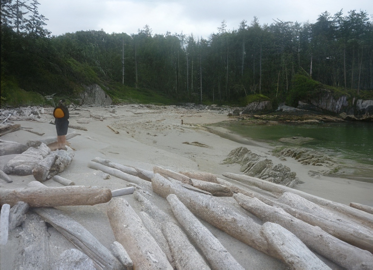
Burnett
Bay
This
two-mile-long sand beach is one of the finest of this type on our coast.
Predictably, expect substantial surf except at the north and south ends where
there is good protection at some tides.
North Burnett Bay
51°8.04'N 127°41.36'W—19
There are some small islets which at lower tides provide very good protection
for landing at the north end of the beach. The photo shows these islets. The larger of the islets is tomboloed to the
smaller islet/rock to its northeast at tides below 2.5 metres. In this circumstance landing behind islets to
the southeast of the largest islet is virtually without surf on relatively calm
days and likely without surf on most days paddlers would be out. Between 2.5
and 3.3 metres of tide the tombolo between the islets floods and it is still
not difficult to land but some turbulence is getting in from the northwest. At tides above 3.3 metres the tombolo between
the inner rock/islet and the shore floods and the protection of the islets is
substantially diminished. This end of
the beach boasts a small cabin and there is nearby water.

South Burnett Bay
51°6.33'N 127°40.56'W—20
This appeared to be the most popular camping spot in the area. Three sites
showed evidence of use. There are two
small pockets east of Bremner Point but west of the river outlet. The most westerly is a small pocket that is
very protected for landing at about half tide and there is room for a couple of
tents above summer highs. The more
easterly of these two pockets is obviously well used and has 5 well cleared
upland sites (pass under the arch). This
beach is more accessible at tides above half. Both of these beaches are accessible without
surf at tides below half on calm days but expect a long carry. When we were there, there were the remnants a
well-established camp on the north shore of the river mouth. It was not clear to us exactly how one gets to
this side of the river in a small boat as at lower tides the beaches are prone
to surf. A note in the log books in the
cabin at the north end of the beach suggest entry into the river mouth is
possible at high tides in a small boat. If
you choose to try this approach, the main channel is right beside the
dome-shaped rock at the southwest entrance to the river, but be aware that when
we were there at higher tide the entrance was very rough and not a
straightforward affair at all. We
concluded that most people probably camp at the south end of the beach unless
they prefer the cabin at the north end.

Entrance to River
This guide was
prepared and researched by Reale Emond, Glenn Lewis, Geoff Mumford, and Karina
Younk. Photo credits to Glenn Lewis, Geoffrey Mumford & Karina Younk.

We are indebted
to the work of John Kimantas and especially to his book The Wild Coast Volume 2 (Whitecap Books, 2006).
It is the third
of three guides that cover the outer coast from the north end of Banks Island
to approximately Cape Caution. The
surveys and guides were done over three years between 2011 and 2013.
Our
principal goal was to make the coast more available to paddlers of average
paddling ability with west-coast experience. Most of the people involved in the
project were over sixty with many over 70. We hope we have shown that with
reasonable skills interpreting weather and water conditions, it is not
necessary to be a powerful, highly skilled paddler to be safely in the survey
area. We were pleased to find good camping sites reasonably spaced throughout
the area despite a reputation among some paddlers that they did not exist.
Our second goal
was more of a hope. We think that if people come to our outer central and north
coast to enjoy its splendor they will be moved to act as stewards and advocates
for an area that is seldom on many people’s radar but in our view is a unique
national treasure that is under great threat from a largely uncaring industrial
society.
No comments:
Post a Comment