Showing posts with label Trip Reports. Show all posts

Wednesday, June 18, 2025

West Coast of Calvert Island with a Few Sites Near Cape Caution - A Field Guide for Paddlers


West Coast of Calvert Island

 with a Few Sites Near Cape Caution

A Field Guide for Paddlers


Why?

This is chapter three of an effort started in 2011 to fill in some gaps in the Wild Coast series of guides by John Kimantas.  The 2011 effort resulted in a guide for the west coast of Banks Island, and in 2012 we produced a guide for west coasts of Aristazabal, Price and Athlone Islands.  Like the two earlier guides, sites covered by The Wild Coast: Volume 2 are not included except by reference.

Who?

In 2013 we had ten paddlers, mainly from the Nanaimo Paddlers.  We started in Bella Bella near the end of July and finished in Port Hardy mid August.  We had remarkably good weather and calm seas for all but the last day or two and the water was noted to seem warmer than usual.  Nice for swimming and for making fog.  All members of our group contributed to the survey effort with most of the photos taken by Geoff Mumford, Karina Younk and Glenn Lewis.  Most of the post trip organization of information was done by Reale Emond and Glenn Lewis.

Overview of the Surveyed Area

From the northwest corner of Calvert Island to the south end of Burnett Bay is a little more than

50 nm, going more or less directly.  The entire distance, except for some of the south shore of Calvert Island, is entirely exposed to the open Pacific.  The area is well known for its large sand beaches that seldom get visited other than by the ever present wolves.  Many of the beaches have little shelter from swell, and our goal was to find places which allowed for landing without surf when conditions were suitable for paddlers of ordinary ability.  Except for the Hakai Beach Institute located in Pruth Bay at the north end of Calvert Island the entire survey area is uninhabited.  When crossing from Calvert Island to the mainland, paddlers might see a few sports fishers from Rivers Inlet, but this year even they were not in evidence.  There is a considerable amount of marine traffic using Fitzhugh Sound and the coast south of Calvert.  Paddlers will want to be aware of this situation and possibly keep in contact with Vessel Traffic Services during exposed crossings.  Coming home mounted on the bow bulb of a cruise ship would take some of the fun out of paddling in the area.

The area is generally flat near the coast but Fitzhugh Sound, Rivers Inlet, and Smith Sound can cause strong inflow/outflow winds and currents which can contribute to the challenges of rounding Cape Caution.  The southwest shore of Calvert Island is also prone to very choppy conditions, and the NW wind seems to access most of that area unimpeded.  Whether this situation is because of the low elevation of most of the western half of Calvert Island, because of inflows into Rivers Inlet in the afternoon or the relatively shallow water closer to shore, we don’t know.  One solution is to paddle half a kilometre off shore of the islands, another is to paddle inside of the islands, rocks and reefs.

The area was easy to paddle during our trip, but the lack of cover from the open ocean means that sometimes paddlers would need a much larger stock of discretion rather than valour.  There is a small cabin near the north end of Burnett Bay which appears to be well used by kayakers and a couple of camps abandoned by the late Bill Davidson.  Obvious evidence of past First Nations use is harder to discern than in the areas where beaches were more amenable to being shaped for harvesting purposes.

Monday, June 16, 2025

West Coast of Aristazabal, Price & Athlone Islands – A Field Guide for Paddlers Includes Rennison and Anderson Islands


West Coast of Aristazabal, Price & Athlone Islands 
Includes Rennison and Anderson Islands
A Field Guide for Paddlers


Why?
This guide is chapter 2 of an effort started in 2011 which sought to fill in some gaps in the Wild Coast series of guides by John Kimantas.

The 2011 effort resulted in West Coast of Banks Island – A Field Guide for Paddlers.  Like the Banks Island guide, areas covered in The Wild Coast Volume II are not included in this chapter, except by reference.

Who?
In 2012 nine members of the Nanaimo Paddlers club decided to survey the western shores of Aristazabal (including all of Rennison Island and Anderson Islands), Price and Athlone Islands.  It was a good test for the campsites as eight tents needed to be accommodated.  All members of the group contributed to the gathering of information.  Most of the photographs were taken by Geoff Mumford and Karina Younk.  Most of the pre-trip survey preparation and post-trip organization of the information was done by Reale Emond and Glenn Lewis.  


Overview of the surveyed area
From Oswald Point on the northwest corner of Rennison Island to Cape Mark southwest of Athlone Island is about 80nm going more or less directly.  However, those wanting a shorter open water crossing of Laredo Sound at the south end of Aristazabal and an alternative to the 8-9 nm crossing of Milbanke Sound at the south end of Price will need to paddle an additional 15-20 nm.  The area is isolated but not so remote or unoccupied as Banks Island.  Sports fishers from the North King Lodge located in Borrowman Bay on Aristazabal Island will be seen from the north end of Aristazabal down at least as far as Clifford Bay.  Similarly, the West Coast Resorts lodge near Athlone Island spread their guests between Cape Swain and Cape Mark.  In an area that is several hours away from the life boat stationed in Bella Bella, the presence of sports fishers provides some additional support should an emergency arise.

The survey area is uniformly quite flat and is largely part of a formation known as the Milbanke Strandflat.  This means that shallow waters extend west of the main shore line.  Between Cape Mark and Oswald Point there are between 500-1000 islands or islets and perhaps twice that number of rocks and reefs, mostly within a mile of the main islands.  Most of the time, paddlers will be either fully or partially protected from sea states farther to the west.  Another benefit of the low topography is that most of the clouds that will drop rain on the hills and mountains to the east carry on by without stopping.  Ocean swell that was often substantially blocked by Haida Gwaii further to the north becomes more noticeable as one moves south from Clifford Bay on Aristazabal.
We found the area relatively easy to paddle for a western exposure, mainly due to the large stretches of inshore paddling available that were fully protected and the relatively short exposures to the open ocean.  Paddling the area does require open water crossings of Laredo Channel (about 4.5 nm), Laredo Sound (about 6.5 nm from the south end of Aristazabal over to Price going directly), Milbanke Sound (about 5 nm from Langford Cove on Price Island to Salal Island or 8-9 nm going directly from the south end of Price Island to Athlone Island).  Aside from the presence of sports fishers, the area shows few signs of human use except for two cabins near the northern end of Aristazabal and a whale observation post at Ulric Point.  Weather information comes from the Klemtu repeater in the northern sections and the Calvert Island repeater further south; reception is generally quite good.

Sunday, June 15, 2025

West Coast Banks Island - A Field Guide for Paddlers


Why?

Since the publication of the Wild Coast Series by John Kimantas and Boat Camping Haida Gwaii by Neil Fraser, kayakers have been able to paddle almost all of the west coast of British Columbia more safely and enjoyably. A gap in the Wild Coast series, quite understandable given the size of the project, is a lack of information for most of the west coast of the outer islands from Larsen Harbour on Banks Island to Cape Calvert on Calvert Island. The information provided here aims to fill part of that gap. Areas already covered by the Wild Coast series are not included.

Who?

Four members of the Nanaimo Paddlers (its what it sounds like) decided to survey the western shores of Banks and Aristazabal Islands in the summer of 2011 and make the collected information available to those who can use it. The collective experience of those involved in the survey and preparation of this field guide includes paddling all but about 60 miles of the western shores of British Columbia South of Prince Rupert and Cape Knox to Tofino. An injury resulted in the trip being diverted homeward after the completion of the west coast of Banks Island leaving Aristazabal for another day.


Overview of the surveyed area

From Deadman Point on the northern tip of Banks to the area around the southern tip is between 45-50 nautical miles going more or less directly. Subjectively, aside from headlands like Cape Scott, Cape Cook and Estevan Point, we found the area comparable to the west coast of Vancouver Island north of Tofino in terms of challenges for the touring paddler.

The area is very isolated and paddlers should plan to look after themselves, expecting help from outside to come, but perhaps not in a very timely way. In 2011, there were no people living along the west coast of Banks and we encountered only one sail boat and no sports or commercial fish boats near to shore. The shore shows very few signs of post contact historical development. In short, it is an isolated wilderness experience. Leave your ego and schedule at home, bring an extra VHF, and enjoy.

Monday, September 11, 2023

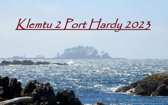
Klemtu 2 Port Hardy 2023


After six years of retirement preparations, Covid restrictions and the business of selling our house, buying a new one and moving to Everett it was time to return to the BC coast and the Great Bear Rain Forest.  It had been even longer for my paddling partner, Dave Resler, who made it clear that he was going, no matter what.  All he asked me to do was all the planning and preparations.  Piece of cake, right? 

Honestly, I wasn’t convinced that he would really be able to go so I put off planning longer than I normally would have and when I did start I found that all of my nautical charts and charting tools had disappeared in our move.  Unbelievable!  I bought enough replacements to cover the waters between Port Hardy and Caamano Sound as I figured that I could come up with something interesting there but then found that Garmin had discontinued support for Homeport, the charting program I use.  Double unbelievable!  I had lost significant functionality in their decision to cast me aside but figured out enough workarounds to where I could get by. 

With my new charts and crippled Homeport application I decided to create a trip that would be familiar yet have enough new twists and turns to be interesting.  I felt that it would be most efficient (and fun) to ferry up to Klemtu and paddle back to Port Hardy by whatever route struck our fancy and that the conditions would accommodate.  Most of our “planned” campsites were just options and not hard and fast daily destinations.  Heresy, for some, but that's how I roll.  It would be a vague route that would allow us to change with the wind.  The chart work took me a couple of months of consistent work to complete. 

After losing all of my charts, finding my charting program “broken”, several of my dry bags delaminated, battery cases rusted shut, some safety gear expired or worn out and other key gear missing in action I shouldn’t have assumed that I was through the “broken phase” of the trip.  And I wasn’t. 

Dave had a new Garmin Mini 2 that would allow limited texting.  Since this brought a new expectation to our trips and because I was sensing that there might be some communication issues regarding conditions, movement, etc. I asked local paddler, mentor and all around good guy, Bill Porter, to act as our interpreter when and if a message really needed clarification and the guy who would handle things if we really needed help. 

This is the story of the Carhartt Duct Tape Tour.

Saturday, October 2, 2021

Klemtu 2007

Originally Published 3/16/2008


When Dave and I started talking about a trip for 2007 we didn’t have approved time off from our jobs.

We didn’t have a route.

We didn’t have a plan, really.

We were inspired to get back to the coast and do something a little more ambitious than we had done before.

The 2005 trip introduced me to the area and convinced me that I had to return again and again and again until I could say that I had paddled the West Coast of Canada. Bumping into Keith Webb at the conclusion of that trip in the bar at Shearwater was amazing fortune as he introduced us to the legend of Kayak Bill and planted some seeds for this trip. His on-line article for Sea Kayaker Magazine fertilized those seeds. We walked into that bar motivated by pizza and beer and walked out inspired by the legend of a dead man.  If you are unfamiliar with Kayak Bill read Keith's excellent online article here: Kayak Bill - A Requiem
John Kimantas, a Canadian author and sea kayaker, had quietly released a book called "the Wild Coast" which covers kayaking the west coast of Vancouver Island. When I received the book for Christmas I hadn’t seen or heard of it before. What a surprise. Detailed routes, great photos, good natural history. Dave and I were inspired to start planning our next trip.

Work kept me close to home in 2006 so I wasn’t able to travel but Dave did go back to the Central Coast and spent a rainy week at Cultus Sound with Larry and Connie Longrie. During that time John Kimantas released the Wild Coast 2 which covers the coast from the north end of Vancouver Island to Prince Rupert. John’s descriptions of campsites that Dave and I had stayed at were spot-on and gave us confidence in using the Wild Coast 2 as a planning tool for the 2007 trip. We wanted to spend as much time as possible “outside” and finding information on the Outside Passage was not as easy as the Inside Passage. The Wild Coast 2 filled in lots of blanks.

Dave and I both wanted to explore the area between Banks Island and Milbanke Sound but recognized that we were challenged by logistics. We needed to try to fit our trip into a two week window if we were going to persuade a third person to join us. We felt that we needed a third partner to share this trip with and, as you know, finding the perfect adventure travel companion is tough. We wanted the safety and strength that a skilled and level-headed partner would provide.

I knew Greg Polkinghorn a bit from work and had paddled with him a few times. I knew that he was stronger than most paddlers had reason to be and had more experience on kayaking trips than I had. Smart guy, strong, no hidden agenda. I had shown him photos of the Bella Bella trip and knew that he was interested but he had lots of competing priorities. I threw it out there to see if he would consider it and to our delight Greg signed on!

Dave, the best qualified to design a trip plan assigned the task to me. Not sure why he did that but I shared my ideas with Keith Webb and John Kimantas. Keith was very generous and spent time on-line and on the phone candidly discussing his experiences and learnings chasing “Kayak Bill”. He also shared copies of Bill’s charts along with GPS coordinates of campsites that worked and didn’t work at spring tide levels. John Kimantas encouraged me where I wavered, confirmed the validity of some thoughts and suggested that I re-examine my plan where it didn’t pencil out for him. Eventually I submitted a plan to Dave who did the preliminary chart work and made a few suggestions. That plan, for the most part stuck and that was what we showed to Greg. Nothing extreme or crazy. Bigger crossings than I had done before. Reasonable exposure with bailouts. Three Kayak Bill campsites with the possibility of more. Maybe see a white bear. Ton’s of new territory. A bit of time in familiar haunts. Sounded like a great trip.

Saturday, September 11, 2021

Bella Bella 2005

Originally published 8/6/2005


Seattle to Port Hardy
7/23,  Saturday,  Day 1
Clear


Traveling from Seattle to Bella Bella, British Columbia takes about 25 hours. Some of that time is spent waiting for ferries but you won’t get there much quicker than that.  Maybe you can take a later Tsawwassen ferry and wait in a longer line.  Your call.  I hate being late, though.  That’s my personal problem so 25 hours it is.

Dave and I left Shoreline at 2:30 AM on Saturday the 23rd of July.  We stopped briefly at the rest stop short of Arlington to meet up with Larry and Keith who we would be paddling with.  All three of them are veterans of numerous kayak trips, with Larry and Keith having visited this area at least four times in the past.  Dave had been to the region once.  This was my first overnight kayak trip, period.

Dave explained to me how each of us had particular job responsibilities to perform:
Keith enjoyed cooking and had done all of the meal planning so he had procured the food and would prepare the meals.
Larry, having a pyromaniacal bent, would build and nurture the fires.  Any food prep done over an open fire was also his responsibility.  
Dave’s job, he claimed, was to clean the fish that our meal plan dictated we provide by hook or by crook (more on that later).  
My job was to clean up after the meals.  I inherited that responsibility from Dave who considered cleaning fish a major step up.

Leaving the Arlington rest stop we caravanned to the international border where we were “greeted” by a singularly humorless Canadian border guard.  Think of a young Randy Newman with a short early-70's Caucasian Semi-Afro receiving a failing grade at UC and you have a visual of this guy in his glass booth.  We guessed that his demeanor was due to his disappointment in not being a part of the big drug bust on the BC-Bud-Smuggling-Tunnel under the border the week before.  http://www.historylink.org/File/7928

Picture him in a cold booth and uniform
Photo of young Newman, early 1970s - Getty Images

Or maybe he had been a part of it yet now found himself back in his cold, dark guard shack reviewing passports of kayaking reprobates.  A bitter pill to swallow.  I should mention that one of us had been denied entry into Canada twice for a “crime” that had since been de-criminalized.  I will say no more about it other than to say that it wasn’t me.  We didn’t know what the computer records told him and weren’t about to ask as he had the look of someone desperate to get even.  He didn’t keep us long, though, as he was clearly too depressed to concentrate or have a meaningful conversation so we were off for our rendezvous with the 5:15 AM Tsawwassen ferry to Nanaimo.

Wednesday, February 3, 2021

Side Bay 2 Tofino 2014

Image by Greg Polkinghorn

Paddling the west coast of Vancouver Island, in one trip or in many, can be complicated.

There are few hard surfaced roads that cross from the inside to the outside of the island.  Owing to the extensive logging that has been undertaken there are a number of gravel roads that provide access but their condition varies and they are subject to closures.  They can also take their toll on your vehicle. This seriously complicated the Point A to Point B route that we were going for.


The route is exposed and subject to changing weather.  Conditions can get very large and you have to pay attention and stay within your skill set.  Some stretches of the coastal route can be long, requiring extended periods of cockpit time and potentially difficult surf landings and launches.  Many of the places that make sense to land were First Nation village sites or fish camps hence Maa-nulth Treaty lands that require prior approval of the local band office prior to entering.  For the most part if there is a good beach it has First Nation’s historical significance and should be treated as such.

Enter my friend and Nanaimo area paddler Glenn Lewis.  He offered to ride with us from his house near Parksville up island to Port Alice and out 60-some miles of bad roads to Side Bay where he dropped us off and then delivered the vehicle to the Ucluelet Campground where we hoped to finish in 2-3 weeks.  His knowledge of the logging roads out of Port Alice proved invaluable as we made all the correct turns and arrived at Side Bay around 4:00PM.  Oh yes, his wife Joan then drove the 2 hours out to Ucluelet to pick up Glenn and bring him back home.  Amazing, right?  On the way up he provided weather and site-specific data that helped us solidify our route.


Sunday, March 29, 2020

Nisqually Reach 2 Alki 2009


I have done a number of day trips in the South Sound but I always wanted to paddle back home rather than return to the put-in. I may have mentioned before that Dave and I have a goal to travel from the southern-most regions of Puget Sound to Alaska by kayak. Yes? No? Whatever, we do and this will be done, in chunks. The South Sound to Seattle was a just a piece of it but the timing was never right. Last Fall while eating lunch at Winghaven State Park (a WWT camp site on Vashon Island) we discussed the idea of banging out the South Sound piece during the Winter. We agreed to do it and in January and we did.


Saturday, December 2, 2017

Klemtu 2 Port Hardy 2017


I had been two years without time off from work and was desperate to return to the coast.  Dave wasn’t going to be able to go and Greg was a “maybe” but then became a “99% for sure” so I started planning a 2-3 week trip for the two of us.  I had unfinished business on the outside of Aristazabal and Greg wanted to fish Camaano Sound and the outer coast of Athlone Island.  He preferred to be gone just two weeks while I felt that I needed more time than that to get my head right.  We agreed that the route would allow him to break off for the Bella Bella ferry at any point after Athlone Island while I continued south to Port Hardy.  It was a really ambitious route with a tight timeline, had quite a few moving parts, some unknowns and would require a precisely-timed window of perfect weather.  It would force me to average 16+ nm each day rather than the 13 nm that I seem better suited for.  No real rest days were included.  It would be a continuous grind. 

Original Route

A couple weeks prior to departure Greg was forced to withdraw to attend to some critical family needs so I revised the route and the timeline by cutting out the time built in for fishing.  That increased the daily mileage requirement by a couple of miles each day.  I wasn’t sure that I was up to it.  After all, I was on vacation.


International Relations


The ferry ride from Port Hardy to Klemtu was an interesting exercise in international relations. 

As one of the very first walk-ons I made my way up to my favorite seating area on the starboard side just outside of the Aurora Lounge.  Being first in gave me my pick of seats so I chose a high backed seat front and center to a set of tall windows.  Soon others filed in and a tall European man asked me if the seats were taken.

“Only this one that I’m sitting in” I responded with a smile.


Soon he returned with an older, entourage who I believe were speaking German.  They quickly snapped up all of the seats except for the one beside me.  Several walked up to the seat and looked down at me as if to say “If you move somewhere else we can sit here”.  I was wearing my best welcoming face because I was really looking forward to the company but had no plans of moving.  The group in the adjacent trio of seats had an animated conversation that was interrupted only by glances at me and the seat next me.  It was as if they were trying to figure out whether to ask me to move and failing that which among them would be so unfortunate as to sit next to me.  Finally, a fair-haired woman sat in the seat sideways with her back to me. 

I still had hopes for some friendly conversation over the next 8 hours so I extended my hand and said, “Good morning.  My name is Jon Dawkins.  What is your name?”.

Saturday, November 7, 2015

Bella Bella 2 Prince Rupert 2015

Image by Dave Resler


McLoughlin Bay to Quinoot Point
July 27 / Day 1
Overcast with showers, Winds calm raising to SW @ 12 knots, Calm to 1’ wind waves, Seas rippled


Launching from the rocky beach adjacent to the ferry dock took me back 10 years to my last visit to McLoughlin Bay and first trip to the BC coast.  Dave and I had been drawn together during the ‘70’s by our love of hang gliding.  I had sold him his first glider and we had shared many thermals, windy launches and LZ’s but Dave’s move to Idaho had separated us geographically and we hadn’t stayed in touch.  Then in 2004 Dave contacted me.  He was back in town and it turned out that we shared an interest in paddling.  He had taken a couple of kayak trips with Larry Longrie and Keith Blumhagen and wanted to share the experience with me.  He had brought me to this very beach in July 2005 and introduced me to the magic of the Wild Coast.

By 2007 we had convinced my co-worker, Greg Polkinghorn, that he should come along with us, which he did,  and he was returning now for his 4th trip.  This was my 7th and Dave’s 9th

Inspired by Washington paddler Chuck Curry’s accomplishment of paddling the outer coast to Sitka, we set the modest goal of paddling the outer BC coastline between Prince Rupert and Victoria.  We would do it in bits and pieces.  Emboldened by the “Outer Coast Guides” published by Glenn Lewis with the help of Harriet Rueggeberg, Reale Emonds, Karina Younk, Geoff Mumford and Ursula Vaira we felt the time was right for us to take a sizable bite out of the elephant and paddle the outer coast of Athlone, Price, Aristazabal, Estevan Group, Banks, Porcher and Stephens Island.  I liked the fact that we were starting this trip where my BC coastal explorations had originally begun.

We shared the beach with two Canadians who were bound for Port Hardy in a double.  Their plans called for spending the night, close to Shearwater, on Rainbow Island so that they could start their trip after an evening of pizza and beer.  I suspect that their double, like a good horse, knew its way back to the barn and could deliver the cowboys safely to their camp.  Sounded like a decent idea to me but we were off to the Heiltsuk cabin on Quinoot Point for the first leg of our journey.  


McLoughlin Bay to Quinoot Point Chart

Wednesday, November 13, 2013

Port Hardy 2 Coal Harbour 2013

Image by Dave Resler

Dave and I planned to paddle from Port Hardy around the north end of Vancouver Island…..sort of.  I say sort of because normally there are months of detailed planning that precedes these trips but both of us were so busy with family and work that planning was crammed into very short, individual and last-minute time slots.  Dave, the fastidious planner, would normally have three routes carefully worked out with different timelines for each.  We would pick one as conditions presented themselves and stick with it.  I had learned a lot from him and incorporated his style into my solo trip plan in 2012.  During that trip, however, I found that I was very comfortable going off-plan and switching from one to another as conditions and opportunities presented themselves.

Our basic plan was to paddle up Goletas Channel towards Cape Scott, the far end of Vancouver Island, and down the west coast to Quatsino Sound ending in Coal Harbour.  Conditions and whim would determine our exact path to Cape Scott and our daily distance, overall.  We weren’t pressed for time as we had three weeks. We could finish early or afford to get pinned for days somewhere with no way to get off the beach.

Ultimately, tides, winds and sea state would dictate progress and we could choose to cross Goletas Channel to the God’s Pocket complex, Nigei Island and Hope Island areas to just poke around and hide from high winds and weather or just hang out.  We could also choose to benefit from the favorable morning ebbs that should push us up the channel and on our way.  Current in Goletas Channel runs up to 3 knots with intersecting currents running to 5 knots providing an environment where rips and ragged water can be generated.  Throw a west wind against the ebb and progress could become arduous and busy. 


Between Vancouver and Hope Islands Goletas Channel escapes into the open Pacific where Nahwitti Bar rises up from the depths to confound and anger the current, winds and swell.  Vessels of all size consider conditions on the bar and it can go off.

Friday, August 17, 2012

Klemtu 2 Port Hardy 2012


I had no burning desire to take a solo trip.  It was just that my paddling partners weren't available to travel and I did have a burning desire to go north for a bit, so solo it was.   I liked the idea of being able to dictate my own schedule, poke around instead of focus on mileage, change my route without debate, take a day off or not as the spirit moved me, etc.  The solo-thing meant, to me anyway, that I would need to select a route that wasn't too ambitious and that I would really have to pay attention to the conditions so that I stayed within my skill set.

The route would be an "Inside-Outside" sort of thing with plenty of familiar locales to provide comfort plus some new sights and exciting challenges.  Since I had never spent much time on the Inside Passage I would start by flavoring some of the long deep reaches.  I would be passing four Kayak Bill camps and hoped to find his last camp on Gosling Island clean enough to camp at.  The outside of Calvert had called to me for years so, conditions allowing, I would spend a couple of days checking that out.   Finally, I had spent some time discussing the crossing of Queen Charlotte Strait with Glenn Lewis of Nanaimo and, if I lost the usual number of days to foul weather, I would be making that crossing when currents were running high in Gordon and Goletas Channels so a different tact would be employed.


Klemtu to Sarah Island
7/27 Friday, Day 1
60 degrees, Overcast, calm winds and seas


I met the Nanaimo Paddlers at the Bear Cove dock.  Really a nice bunch of folks who were heading for the outside of Aristazabal, Price and Athlone and who would spend the next the 12 or so hours trying hard to convince me to come along with them.  Made for a very enjoyable ride to Klemtu.

Northern Expedition in Bear Cove

Thursday, February 4, 2010

the Outside Passage 2009


A chance encounter with Chuck Curry in 2007 set our minds in motion and inspired this trip that we embarked on July 17.  We were camped at the west end of Higgins Passage on July 18, 2007 when Chuck stopped by to chat.  A Puget Sound paddler, he was going solo from Port Hardy to Prince Rupert.  He had crossed Milbanke Sound earlier that day in the same dense fog that Greg had unerringly led the 15.2 NM route from Milne Island to Higgins.  After about 20 minutes Chuck paddled off towards the west.  He still had some miles to make.  We would meet up with him later in Seattle and learn that he had taken a route outside of Aristazabal, Trutch and Banks Islands.  He had intended to go outside of Porcher, also, but ducked inside because he was running out of food.  We were inspired to attempt his route, in reverse, and that is what we spent the previous two years planning.


An extremely rough sketch of our intended route was to go through Edye Passage at the north end of Porcher Island and hang a left, keeping open ocean to our right until the time came to cross Queen Charlotte Strait for Port Hardy.  We didn’t have the expectation that conditions would allow that but it was still the dream.  The BC Coast isn’t known for producing the perfect stretch of weather it would take to allow us to consider that a viable route so an Inside/Outside Route is what we ended up doing and we made choices each day as to what route to take.  We had a two week hard-date where we had to get Greg to Klemtu or Shearwater for his ferry ride back to Port Hardy so we couldn’t afford to get pinned down by inclement weather.


West Coast British Columbia
Map from Encarta World Atlas

For the benefit of family and friends Dave carried a Spot Satellite Messenger on his back and we “sent off a Spot” each morning when we launched, at lunch if we put ashore and again when we reached a campsite.  When we had no option to get out of our boats for lunch we activated it on Dave’s back or not at all.  These devices seem to have had some reliability issues, however, Dave’s worked perfectly and posted each Spot that we sent.  For safety’s sake I wore an ACR Terrafix EBIRB that we would rely upon if we required extraction.


Seattle to Prince Rupert

At 2:15 AM on the morning of July 16 Dave arrived at my house.  We loaded the truck and started north.  Two hours to Tsawwassen, 30 minutes on the dock, a two hour crossing to Nanaimo and five more driving up the island would bring us to Port Hardy.  On the way up-island we made a stop at Campbell River to pick up Dave’s fishing license and to mail the food supply for the second half of our trip (55 pounds) to Klemtu where we would pick it up two weeks hence. 

Waterfront Park