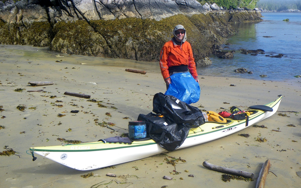
Wednesday, June 18, 2025

West Coast of Calvert Island with a Few Sites Near Cape Caution - A Field Guide for Paddlers


West Coast of Calvert Island

 with a Few Sites Near Cape Caution

A Field Guide for Paddlers


Why?

This is chapter three of an effort started in 2011 to fill in some gaps in the Wild Coast series of guides by John Kimantas.  The 2011 effort resulted in a guide for the west coast of Banks Island, and in 2012 we produced a guide for west coasts of Aristazabal, Price and Athlone Islands.  Like the two earlier guides, sites covered by The Wild Coast: Volume 2 are not included except by reference.

Who?

In 2013 we had ten paddlers, mainly from the Nanaimo Paddlers.  We started in Bella Bella near the end of July and finished in Port Hardy mid August.  We had remarkably good weather and calm seas for all but the last day or two and the water was noted to seem warmer than usual.  Nice for swimming and for making fog.  All members of our group contributed to the survey effort with most of the photos taken by Geoff Mumford, Karina Younk and Glenn Lewis.  Most of the post trip organization of information was done by Reale Emond and Glenn Lewis.

Overview of the Surveyed Area

From the northwest corner of Calvert Island to the south end of Burnett Bay is a little more than

50 nm, going more or less directly.  The entire distance, except for some of the south shore of Calvert Island, is entirely exposed to the open Pacific.  The area is well known for its large sand beaches that seldom get visited other than by the ever present wolves.  Many of the beaches have little shelter from swell, and our goal was to find places which allowed for landing without surf when conditions were suitable for paddlers of ordinary ability.  Except for the Hakai Beach Institute located in Pruth Bay at the north end of Calvert Island the entire survey area is uninhabited.  When crossing from Calvert Island to the mainland, paddlers might see a few sports fishers from Rivers Inlet, but this year even they were not in evidence.  There is a considerable amount of marine traffic using Fitzhugh Sound and the coast south of Calvert.  Paddlers will want to be aware of this situation and possibly keep in contact with Vessel Traffic Services during exposed crossings.  Coming home mounted on the bow bulb of a cruise ship would take some of the fun out of paddling in the area.

The area is generally flat near the coast but Fitzhugh Sound, Rivers Inlet, and Smith Sound can cause strong inflow/outflow winds and currents which can contribute to the challenges of rounding Cape Caution.  The southwest shore of Calvert Island is also prone to very choppy conditions, and the NW wind seems to access most of that area unimpeded.  Whether this situation is because of the low elevation of most of the western half of Calvert Island, because of inflows into Rivers Inlet in the afternoon or the relatively shallow water closer to shore, we don’t know.  One solution is to paddle half a kilometre off shore of the islands, another is to paddle inside of the islands, rocks and reefs.

The area was easy to paddle during our trip, but the lack of cover from the open ocean means that sometimes paddlers would need a much larger stock of discretion rather than valour.  There is a small cabin near the north end of Burnett Bay which appears to be well used by kayakers and a couple of camps abandoned by the late Bill Davidson.  Obvious evidence of past First Nations use is harder to discern than in the areas where beaches were more amenable to being shaped for harvesting purposes.

Monday, June 16, 2025

West Coast of Aristazabal, Price & Athlone Islands – A Field Guide for Paddlers Includes Rennison and Anderson Islands


West Coast of Aristazabal, Price & Athlone Islands 
Includes Rennison and Anderson Islands
A Field Guide for Paddlers


Why?
This guide is chapter 2 of an effort started in 2011 which sought to fill in some gaps in the Wild Coast series of guides by John Kimantas.

The 2011 effort resulted in West Coast of Banks Island – A Field Guide for Paddlers.  Like the Banks Island guide, areas covered in The Wild Coast Volume II are not included in this chapter, except by reference.

Who?
In 2012 nine members of the Nanaimo Paddlers club decided to survey the western shores of Aristazabal (including all of Rennison Island and Anderson Islands), Price and Athlone Islands.  It was a good test for the campsites as eight tents needed to be accommodated.  All members of the group contributed to the gathering of information.  Most of the photographs were taken by Geoff Mumford and Karina Younk.  Most of the pre-trip survey preparation and post-trip organization of the information was done by Reale Emond and Glenn Lewis.  


Overview of the surveyed area
From Oswald Point on the northwest corner of Rennison Island to Cape Mark southwest of Athlone Island is about 80nm going more or less directly.  However, those wanting a shorter open water crossing of Laredo Sound at the south end of Aristazabal and an alternative to the 8-9 nm crossing of Milbanke Sound at the south end of Price will need to paddle an additional 15-20 nm.  The area is isolated but not so remote or unoccupied as Banks Island.  Sports fishers from the North King Lodge located in Borrowman Bay on Aristazabal Island will be seen from the north end of Aristazabal down at least as far as Clifford Bay.  Similarly, the West Coast Resorts lodge near Athlone Island spread their guests between Cape Swain and Cape Mark.  In an area that is several hours away from the life boat stationed in Bella Bella, the presence of sports fishers provides some additional support should an emergency arise.

The survey area is uniformly quite flat and is largely part of a formation known as the Milbanke Strandflat.  This means that shallow waters extend west of the main shore line.  Between Cape Mark and Oswald Point there are between 500-1000 islands or islets and perhaps twice that number of rocks and reefs, mostly within a mile of the main islands.  Most of the time, paddlers will be either fully or partially protected from sea states farther to the west.  Another benefit of the low topography is that most of the clouds that will drop rain on the hills and mountains to the east carry on by without stopping.  Ocean swell that was often substantially blocked by Haida Gwaii further to the north becomes more noticeable as one moves south from Clifford Bay on Aristazabal.
We found the area relatively easy to paddle for a western exposure, mainly due to the large stretches of inshore paddling available that were fully protected and the relatively short exposures to the open ocean.  Paddling the area does require open water crossings of Laredo Channel (about 4.5 nm), Laredo Sound (about 6.5 nm from the south end of Aristazabal over to Price going directly), Milbanke Sound (about 5 nm from Langford Cove on Price Island to Salal Island or 8-9 nm going directly from the south end of Price Island to Athlone Island).  Aside from the presence of sports fishers, the area shows few signs of human use except for two cabins near the northern end of Aristazabal and a whale observation post at Ulric Point.  Weather information comes from the Klemtu repeater in the northern sections and the Calvert Island repeater further south; reception is generally quite good.

Sunday, June 15, 2025

West Coast Banks Island - A Field Guide for Paddlers


Why?

Since the publication of the Wild Coast Series by John Kimantas and Boat Camping Haida Gwaii by Neil Fraser, kayakers have been able to paddle almost all of the west coast of British Columbia more safely and enjoyably. A gap in the Wild Coast series, quite understandable given the size of the project, is a lack of information for most of the west coast of the outer islands from Larsen Harbour on Banks Island to Cape Calvert on Calvert Island. The information provided here aims to fill part of that gap. Areas already covered by the Wild Coast series are not included.

Who?

Four members of the Nanaimo Paddlers (its what it sounds like) decided to survey the western shores of Banks and Aristazabal Islands in the summer of 2011 and make the collected information available to those who can use it. The collective experience of those involved in the survey and preparation of this field guide includes paddling all but about 60 miles of the western shores of British Columbia South of Prince Rupert and Cape Knox to Tofino. An injury resulted in the trip being diverted homeward after the completion of the west coast of Banks Island leaving Aristazabal for another day.


Overview of the surveyed area

From Deadman Point on the northern tip of Banks to the area around the southern tip is between 45-50 nautical miles going more or less directly. Subjectively, aside from headlands like Cape Scott, Cape Cook and Estevan Point, we found the area comparable to the west coast of Vancouver Island north of Tofino in terms of challenges for the touring paddler.

The area is very isolated and paddlers should plan to look after themselves, expecting help from outside to come, but perhaps not in a very timely way. In 2011, there were no people living along the west coast of Banks and we encountered only one sail boat and no sports or commercial fish boats near to shore. The shore shows very few signs of post contact historical development. In short, it is an isolated wilderness experience. Leave your ego and schedule at home, bring an extra VHF, and enjoy.

Thursday, December 12, 2024

Pack by Numbers

Loaded and trimmed for 3 1/2 weeks

As with all things kayaking, folks have found different solutions that work for them and have differing opinions.  Sometimes the solutions are well conceived and other times not-so-much.  I’m going to discuss my method of packing for a kayaking trip for a single overnight or for a month at a time.  Since I’ve never been out for more than a month my experience hits a wall at that point.  This is what works for me.

My first rule is no deck loading.  The only kit on the deck will be a spare paddle, chart case, GPS and helmet.  Nothing but navigation and safety gear.  There is an issue with windage that comes with deck loading but for me it is about safety and deck access.  When things go sideways that deck may be your only friend and savior.  If it is cluttered with bags, carts and furniture safety can be severely compromised.  My helmet is the only item on the back deck and it is attached in a manner that allows it to be easily removed and discarded if in the way.   


Basics: 

  • Take only what you are really going to need.  
  • Know what every item weighs and distribute the weight so that the boat retains its empty balance.  In other words, it is not stern or bow heavy unless you know from personal experience that it performs better in ALL conditions when loaded in an unbalanced state.
  • Place heavy items closer to the cockpit with lighter items towards the bow and stern. 
  • In your kit selection prioritize packed size over weight. 
  • There should be no unsecured gear in the cockpit. 
  • If you can’t fit it in the hull set it aside for now as you probably don’t need it. 


Take only what you need:

  •  Bring basic clothing.  No extra stuff.  This ain’t no party, this ain’t no disco, this ain’t no fooling around.  Don’t worry about having the perfect layer. 
  • Choose clothing and gear that serves multiple purposes when possible.   If you have a Storm Cag you don’t need a separate raincoat and how many different shoes do you really need?.   
  • Don’t try to pack clean clothes for each day.  That takes up too much space. 
  • Accept that you are going to get dirty and you are going to stink.  Wool stinks less than synthetics.

Gear weight: 

  • Some folks try to color code their drybags or label them with hangtags that describe the contents.  Good ideas and those are nice-to-haves but not gotta-haves.  The gotta-have is how much does each bag or loose item weigh.
  • I use mostly small and/or compression drybags with two tapered bags with purge valves for bow and stern.
  • Once you have all of your necessary gear assembled and bagged, weigh each item and record that on a spreadsheet. 


Start packing it into the boat where it makes sense to you while being mindful of “heavy-to-the-center-light-to-the ends.  Did it all fit INSIDE the hull?  Check your spreadsheet to see how close to balanced are you? Start figuring out what items need to go fore or aft based on weight, size and shape to achieve balanced trim while fitting INTO the hull.  It may take you a while to get the weight properly placed to achieve trim. 

  • Didn’t all fit?  OK, start figuring out what your nice-to-haves are and set them aside.   Keep working at it until you have fit all of your gotta-haves INSIDE the boat in a balanced fashion. If you find room for a nice-to-have that’s a score! 
  • Figure out how much water you REALLY need to carry and put it into bags.  I prefer the MSR Dromedary Bags but others work well and they conform to available spaces.   Plastic water bottles are inefficient as they don’t conform and take up as much space empty as they do when full. 
  • Don’t carry more water than you need.  I seldom carry more than I will personally need for two or three days though I take a 10-liter, 6-liter and 4-liter bag for clean, filtered water.  With my filter I pack two dirty-water collection bags which combined packs smaller than a 2 liter Nalgene bottle.
  • Know that a 10-liter bag holding only 4-liters will fit into spaces that a 4-liter bag will not. Empty Dromedary Bags take up very little space, essentially the size of their non-conformable cap.  Water weighs about 2 pounds per liter and bags can be moved around to balance your boat.  It’s a puzzle.  It’s all about space!

It all fits INSIDE the hull

Practice!!!!!: 

  • Now that you are balanced and have fit your gotta-haves INSIDE the hull start practicing packing and unpacking. 
  • Have two beach bags.  Large Ikea bags are great as they are cheap, light and take up nearly zero space when empty.  Use one for the cockpit forward and one for behind the cockpit.
  • Practice until each item is always in the same place and you can pack fast with or without daylight.  When you have performed enough reps to be efficient you will know exactly what is inside every bag by location and feel and won’t need color-coding or labels.  Once you have practiced enough that you know what each item is and where it lives, practice some more. 
  • Have some spare time before dinner?  Great! Go out into the garage and practice some more.

Stages of packing

You never want to be the last person packed and off the beach because you are fidgeting with your gear and trying to figure out where everything goes.  There are many people that you don’t want to be in this life and the last person off the beach is one of them.  


Kayak Packing Hacks - Kokatat Storm Cag


Image courtesy of Nautopp Kajakcenter Grebbstad


Paddling the Northwest Coast can be a cold and wet affair.  While all Pacific coastal residents own multiple rain jackets made of various materials that feature numerous doo-dahs that seal, vent, hood, snug and are acceptable restaurant and clubwear anywhere in North America very few of them were designed with our disease in mind.  Consequently, for paddling, all of their doo-dahs fall well short of addressing our paddling needs.  With all of the pockets, vents and adjustments they can only be worn under a PFD on the water or on the beach.  Their sole saving grace is that they help us look stylish on the shore.

Enter the Kokatat Storm Cag.  Guaranteed to look goofy on the shore and deemed acceptable clubwear only in British Columbia and Alaska it is featured on the bodies of intelligent paddlers who share our disease anywhere in North America.  It has very few doo-dahs but does have everything that we really need. 

The cut allows it to be pulled on over your immersion gear and PFD while seated in your boat and secures around the coaming of your kayak.     The adjustable hood can be used with or without a helmet.   It features a fleece-lined kangaroo handwarmer pocket with a small velcroed opening allowing you to access pockets in your PFD, There is also a zippered pocket over the kangaroo pocket that I personally find very useful.  If you unzip that pocket you can stuff the garment into it while turning it inside out, Zip that shut and you have a fleece-covered pillow for sleeping. 


The shape of the cag allows you to sit down and tuck your legs inside for warmth.  Sort of a truncated personal bothy bag.  I have bivi-ed in this garment and will attest to the added warmth it provides overall but also for your toes and feet.   


Loosely packed it is scarcely larger than a Jetboil stove and since it is flexible it will fit into a space that the Jetboil will not.  With the Storm Cag you are carrying a rain layer for paddling and for shore, a wind breaker, bothy bag and pillow.  Such a deal and a great space saver inside your kayak.   

This link leads to a short review of the garment.   If you don’t mind looking a tad goofy on shore, take one of these instead of your ramma-lamma dead-dinosaur GoreTex wonder jacket.  I’ve worn mine on BC Ferries, campsites and all over Prince Rupert but never once have been kicked out of a restaurant, lounge or bar.  It is the only rainwear that I pack for kayak trips. 


Wednesday, December 11, 2024

Kayak Packing Hacks - Toilet Paper

Note paperback book in the right corner of the window


How much to bring?  How little can I get away with?  My first coastal trip was with a nature boy who thought that leaves and smooth rocks were acceptable substitutes for #2 hygiene.   He didn’t bring any toilet paper at all and I quickly learned that his smooth-rock-requirement severely limited the number of beaches that we could camp on.  I felt that his Mr. Nature approach was extreme but I wanted to fit in so I pretended to go along with his plan but stole as much toilet paper as I could from the “Queen of Chilliwack’s” mensroom.  I hid this tree-wasting contraband in my boat and would only take it out when needed.  I nervously performed regular inventories and it wasn’t long before I realized that demand was outstripping supply.  What to do?   

On Day 8 I bid adieu to the very last of my secret, stolen toilet paper.  I was really depressed at the thought of what was coming next but then, miraculously, my luck changed.  I found a damp and mouse-eaten paperback book delicately balancing on the empty window frame of the dilapidated cabin on Triquet Island.  I quickly stuffed it down my pants before nature boy could see it and claim it as community fire starter,  No way was I going to share this bounty with him.  He was welcome to all of the barnacle covered rocks and cedar bows that he loved so much and of which there were many. 

At the conclusion of that trip I quit paddling with Nature Boy as I felt that I had learned everything he had to teach me and adopted my own toilet paper sensibilities which embraced "more-is-better" as a key tenet.  The problem, though, was that while TP is light it takes up a lot of space so I found a way to reduce that volume and fit it into spaces that often go to waste.  This is what works for me. 

Four Rolls in the Space of Two

Take a large leak proof bag and shove two rolls of toilet paper into it.  I use 10” wide zip locks.  Sit on the bag to smoosh the rolls and compress the paper and while still sitting on it close the airtight seal.  Now open the seal just enough to insert a straw and suck the remaining air out.  Seal the bag.  Take a length of jute or some other flammable line and tie it around the bag.  Leave a length of line on each sealed bag.  Two to three feet is probably plenty.  Tape the bag tight ensuring that the line is secured to the bag.  Don’t laugh but I pack 8 rolls this way into 4 bags.  Take a bit of colored electrical tape and put a different colored tape on the end of each line.  Red, white and blue is my go-to.  The bags will be oval and elongated.  I shove them one at a time into the very stern or bow of my boat as it is space seldom used for anything else.  Force them back there in an order so that you can remember which string to pull for the next bag of TP (hence red, white and blue).  The jute can be burned and the bags can be reused at home.  

In case you are curious about the book, by wild coincidence that paperback was “Roughing It” by Mark Twain.   I shit you not. 

Monday, November 18, 2024

Kayak Bill Camps - Dallas Island

Originally published October 17, 2017


Dallas Island was one of Bill’s primary camps.  At ~21NM from Shearwater it was midway to his camps on Aristazabal.  Dallas is located along the eastern edge of Milbanke Sound and at the entry to Finlayson Channel where it provided superb shelter and a clear view of conditions on Milbanke Sound prior to committing to crossing over to Higgins Passage.  It was a one or two day paddle from his shack on Brian Clerx’s property that he referred to as “Denny Island Camp”.  By leaving Shearwater near the turn to ebb he could get to the Ivory Island / Blair Inlet complex at the turn to flood.  This would give him a push north to Dallas for the final 7 NM.  If conditions or tides didn’t cooperate there were bivy camps scattered along Seaforth Channel and a couple of camps in Blair Inlet where he could hole up.


In 2007 Dave, Greg and I stayed at the Dallas Island Camp.  Bill had spent eight days here in June 2003 on his way out to his more remote camps and had spent two more nights in October on his way back to Denny Island Camp.  He was headed back to Shearwater to do some painting and resupply for what would turn out to be his last trip.  He had just two months to live.